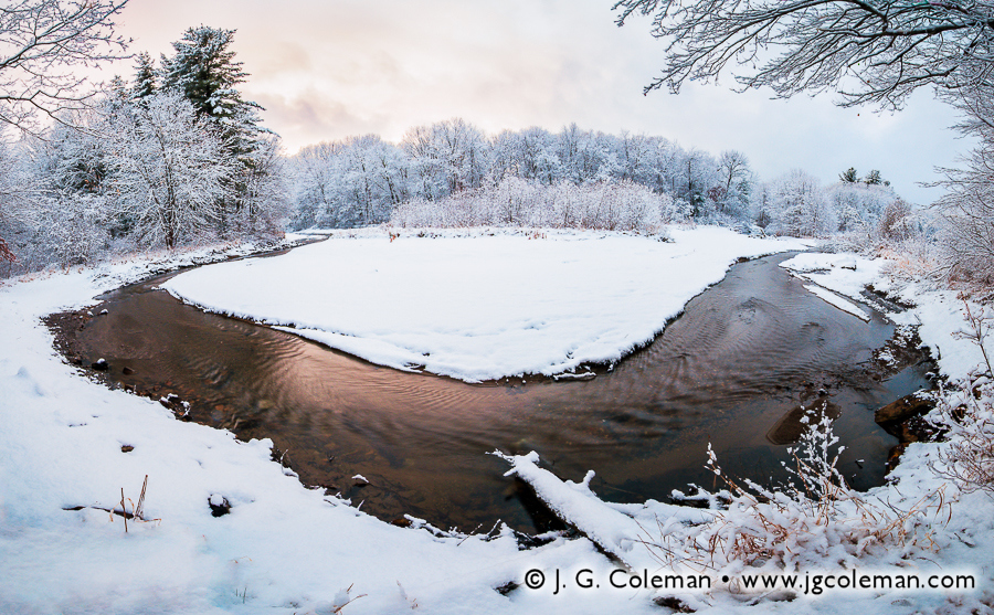
Housatonic River, Cornwall, Connecticut
© 2013 J. G. Coleman
That narrow interval during Autumn, when the forests transition to a collage of saturated colors, is always a magical time in the American Northeast. It’s a fleeting crescendo in which we bid farewell to the warmth and past experiences of spring and summer, enjoying one last, vivid hurrah before being plunged into the frigid months that will see us into a new year. Autumn resonates deeply within the collective psyche of New England. But now that winter is upon us, already blanketing the Connecticut landscape in a few successive layers of snow and ice, I’d like to bring us back just a couple months to the warm colors and soothing temperatures of Autumn 2013.
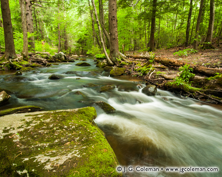
Housatonic River in Connecticut’s Northwest Hills
Cornwall & Sharon, Connecticut
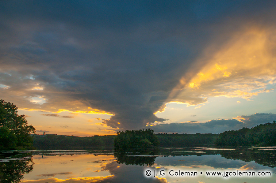
In my new piece, Housatonic Reverie (above), we find ourselves peering out over cold rapids on the Housatonic River in Cornwall, Connecticut. As we follow the undulating waters deeper into the landscape, we are surrounded by woodlands still cloaked in the shadows of twilight. But with fresh morning sun being cast from the east through a veil of mist, a gently-sloping hill on the horizon is set ablaze, becoming a glowing beacon of autumn color in a landscape that is still waking up to a chilly October morning.
Housatonic Reverie is just one of several pieces that I managed to produce as this truly glorious morning on the Housatonic Valley unfolded before my eyes. But if there’s one view of a landscape that I almost never capture, it’s a view which includes me! After all, I’m alone for most of my shoots and I’m generally busy behind the camera. But on this particular morning, I was out shooting with long-time friend and photographer, Ryan Dolan. While I was down on the boulder piles beside the river producing Housatonic Reverie, Ryan managed to frame me up in a unique exposure on black and white film (below).

Housatonic River just minutes after I shot “Housatonic Reverie” (photo at top)
© 2013 Ryan Dolan
His resulting image, which actually appears to have been taken perhaps five or ten minutes after I shot Housatonic Reverie, possesses a fascinating aesthetic that is a world apart from that of my own piece. What I found especially intriguing about his photograph was the timelessness that it so effortlessly conveys. Although we may know that it’s me on those rocks and that this image was taken only a few months ago, when we explore the world that Ryan has framed up here, we find almost nothing that tethers it to modern times. There’s the sense that this image could just as well have emerged from a century-old chest in some dusty farmhouse attic… that the photographer down there on the Housatonic is some anonymous soul of the 1800s that has long since been swallowed up by time and all but lost to history. There’s surely a vein of potent nostalgia in this emotive image, but this piece barely scratches the surface of Ryan’s work. I encourage you to explore more of his photography at ryandolanart.com.
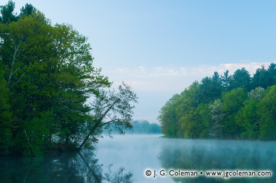
My next piece brings us just a few miles south to Sharon, Connecticut, where the wide, shallow breadth of the Housatonic River snakes peacefully through a deeply-furrowed valley. At every turn the river is flanked by picturesque wooded hills, each one with a distinctive profile wrought in radiused slopes.

Housatonic River, Housatonic Meadows State Park, Sharon, Connecticut
© 2013 J. G. Coleman
Shadowy blue tones, swirling mist and the leafless crown of an overhanging tree conspire to produce a mournful aesthetic in my piece, Twilight on Housatonic Meadows. The conditions on the Housatonic that morning were touch-and-go from a photographer’s perspective, for while the drifting blankets of fog lent a powerfully ethereal quality to the landscape, they also threatened to blot out key elements of the vista. I managed to take Twilight on Housatonic Meadows during a fleeting minute when the dense atmosphere thinned out just enough to reveal sparse wispy clouds and the contour of a distant hill.
- Click here to see more of my work from this magnificent stretch of the Housatonic River in Cornwall, near the rustic West Cornwall Covered Bridge.
- Click here to see more of my work from Housatonic Meadows State Park along the Housatonic River in Sharon, Connecticut.
Connecticut’s Waterfalls Amidst Falling Leaves
Cheshire, Franklin & Simsbury, Connecticut

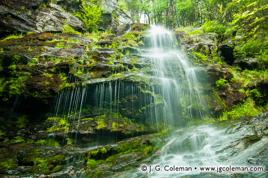
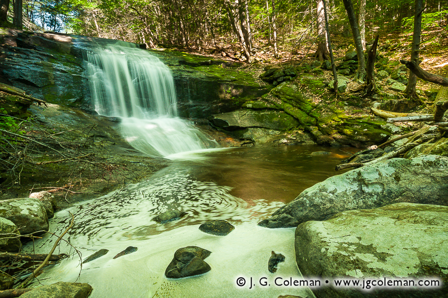
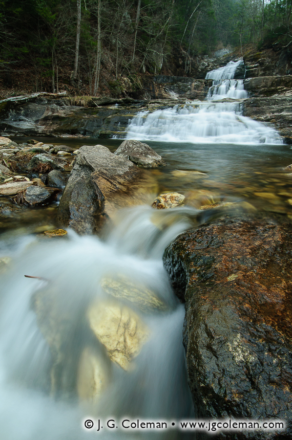
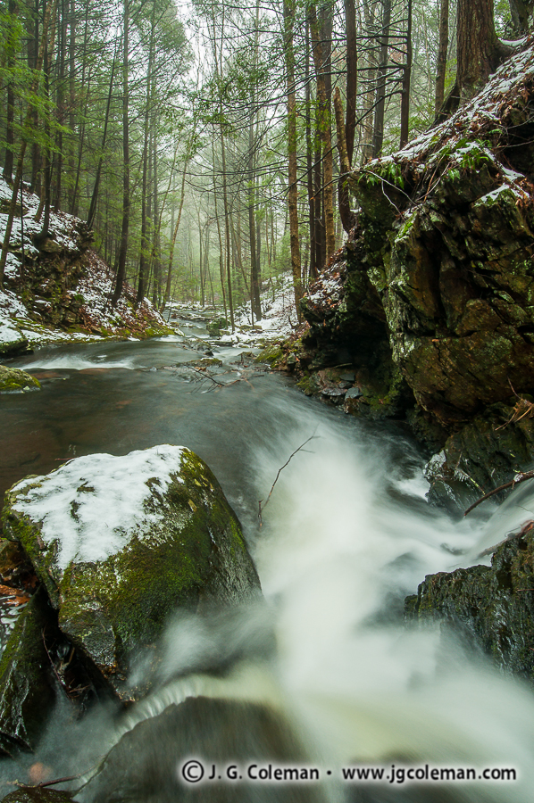
Roaring Brook Falls, Cheshire, Connecticut
© 2013 J. G. Coleman
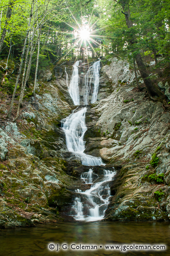
Recently, I released a brand new fine art photography collection titled “Waterfalls of Connecticut“, the culmination of some four years of waterfall photography throughout Connecticut (if you haven’t seen it yet, be sure to check it out). Included in the collection are a few pieces that I managed to produce over this past Autumn, but which were still so new that they hadn’t even been released on my online galleries until now! I’ve finally rolled them out at JGCOLEMAN.COM and here we’ll explore these new works and take a look at how Fall 2013 produced some great conditions for waterfall photography.
Roaring Brook Autumnlands (at right) exemplifies the vivid color palette that we associate with autumn in New England. In this piece, we follow the waters of Roaring Brook Falls as they careen dozens of feet down a cliffside in the woodlands of Cheshire, Connecticut. At the precipice of the falls, we are treated to a cornucopia of saturated colors, from the glowing shades of orange in the forest canopy to the bold blue sky overhead. In truth, it can be extremely difficult to pull colors this “pure” out of any Autumn scene. The critical element in Roaring Brook Autumnlands —the condition that really brought this shot to life— was the magnificent, early-morning sun, which cast warm light upon the forest at the brink of the falls while leaving the cliff-face below painted in shadow. The contrast between dark, glistening rock and fiery, luminous woodlands really breathes life into this vista and reminds us of just how awe-inspiring our landscapes can be during those fleeting months of autumn.

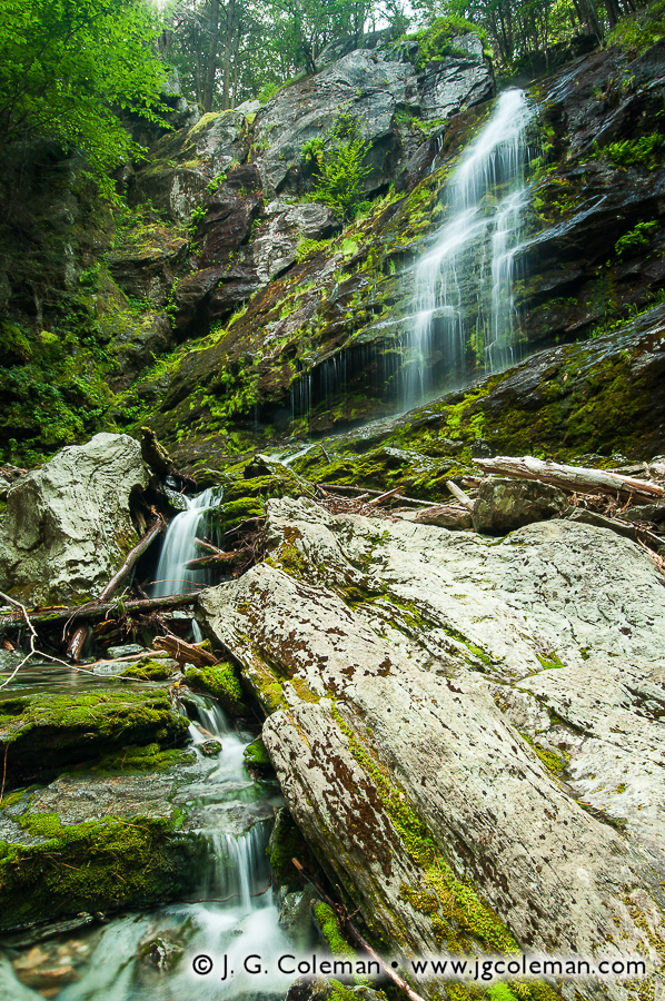
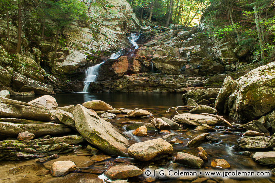
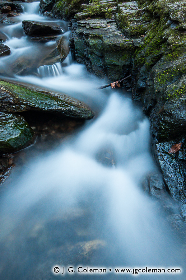
Ayer’s Gap Falls, Ayer’s Gap Preserve,
Franklin, Connecticut
© 2013 J. G. Coleman
My next piece, titled Falls Along the Gap (at right), brings us 40 miles east to Franklin, Connecticut, where gentle wisps of Bailey Brook plunge over rocky outcrops layered with a collage of fallen leaves. Connecticut was particularly dry during much of the Autumn season, a condition which can oftentimes leave smaller waterfalls throughout the state nearly dry. In the case of Falls Along the Gap, however, the reduced water volume on Ayer’s Gap Falls was the crucial ingredient which allowed thousands of autumn leaves to accumulate in areas that might otherwise have been scraped bare by swift currents.
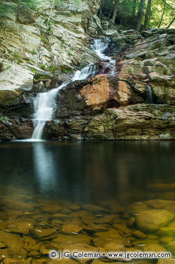
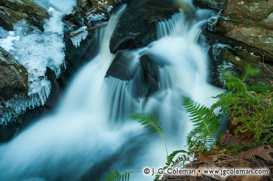
Within At the Northgate (below), my new piece from Northgate Falls in Simsbury, Connecticut, fallen leaves have completely blanketed the forest floor, dramatically framing off the reflecting pool at the base of the cascades. This piece captures a different side of the autumn aesthetic: that wistful atmosphere in which the last throws of autumn feel more like a beautiful, bittersweet farewell rather than an eager stride into the coming months of snow and ice.
Here again, the dry months of summer and early autumn had left this branch of Bissell Brook with greatly reduced water volume. Northgate Falls is not a particularly large waterfall to begin with, but it was rendered especially tranquil at this point in late October.

Northgate Falls, near McLean Game Refuge, Simsbury, Connecticut
© 2013 J. G. Coleman
- Click on any of the waterfall photographs above to see a larger of version at my online galleries. Or, if you’d like to see other work from a given location, check out my galleries for Roaring Brook Falls Park, Ayer’s Gap Preserve and Northgate Falls.
- Click here to see more of my Waterfalls of Connecticut collection, which features the three pieces seen above along with several more spectacular waterfalls from the Nutmeg State.
Wind Gate at the Hudson Highlands
Cornwall, New York
Of course, New England isn’t the only place that offers stunning scenery during Autumn. My next piece brings us 20 miles east of the Connecticut state line to a celebrated place in the history of landscape art: New York’s Hudson River Valley.

Storm King Mountain on the Hudson River,
Storm King State Park, Cornwall, New York
© 2013 J. G. Coleman
In my piece, Storm King Mountainscape (above), we peer out over the wide expanse of the Hudson River beneath a dawn sky awash with color. The facing slope of Storm King Mountain, a prominent, dome-shaped peak that abruptly rises more than 1,300 feet over the river below, glows with with molten color as the earliest sunlight of the morning carves blazing gashes into the shadowy bluffs.
Although Storm King Mountain is the star of this new piece, the photograph was actually taken from the opposite side of the river on a rocky promontory of Breakneck Ridge. Breakneck and Storm King are the distinctive sentinels that form the “Wind Gate”, the mountainous northern entrance into the Hudson Highlands region of New York. While it was early Dutch settlers that coined that term (originally “Wey Gat”), it was the painters of the famous Hudson River School that took to channeling the sublime qualities of this place into profound works of fine art. Throughout the 1800s, Storm King Mountain and Breakneck Ridge were featured in exquisite paintings by Thomas Cole, Samuel Colman, Thomas Benjamin Pope, Regis Frances Gignoux, Homer Dodge Martin and Jasper Cropsey, to name only a few.
- Be sure to browse more of my work from Storm King Mountain and Breakneck Ridge at my online galleries.
A Farewell to Autumn
Wolcott, Connecticut
I’d like to leave you with a piece that portrays barely a foot of the forest floor from edge to edge, but which manages to say just as much about autumn as the vast panorama from Breakneck Ridge or the wide vistas of the Housatonic.

Finch Brook Preserve, Wolcott, Connecticut
© 2013 J. G. Coleman
Produced barely ten minutes from my home in Wolcott, Connecticut, my piece Sugar Maple Castaway is a simple, but potent, expression of the beauty of autumn. Da Vinci once wrote that “simplicity is the ultimate sophistication”, and when we draw our attention to just a single lonely leaf beaming with color upon the forest floor… well, there’s no doubt that the old master was on to something.
As part of J. G. Coleman’s Decor Series prints, many of the works seen here are available at Fine Art America. You are encouraged to visit J. G. Coleman’s Fine Art America eStore, or see all of Fine Art America’s new england art or autumn art.