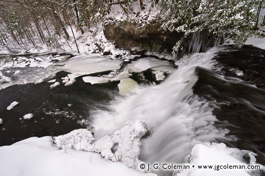
When the first fresh snowfall hits the ground, I’m truly immersed in the momentum of nature towards a certain serenity that comes with cold and quiet. But the frigid air and disconcerting lack of foliage that accompanies a New England winter always tends to overstay its welcome. Then, thankfully, springtime comes along, breathing vitality back into a landscape that has laid dormant and seemingly barren for months. Indeed, Spring has always been a special time for me; a time of rebirth and revitalization after a winter that’s felt just a bit too long. But with summer having drawn to a close and colder months around the corner, I find myself a bit nostalgic for those earlier months of Spring that seem so strangely distant now. And so I offer you my latest series of fine art print releases in the hope that they will bring back memories of the joyous reawakening of nature earlier this year.
Whittemore Sanctuary
Take, for instance, the fern-laden forest understory of Whittemore Sanctuary in my piece “Whittemore Woods”. During my visit in May, this 700-acre tract of woodlands beside Lake Quassapaug in Woodbury, Connecticut truly embodied the springtime transition: that time of year when ferns are beginning to burst forth from the ground in droves, but the trees are still staging their awakening and haven’t quite filled out yet.
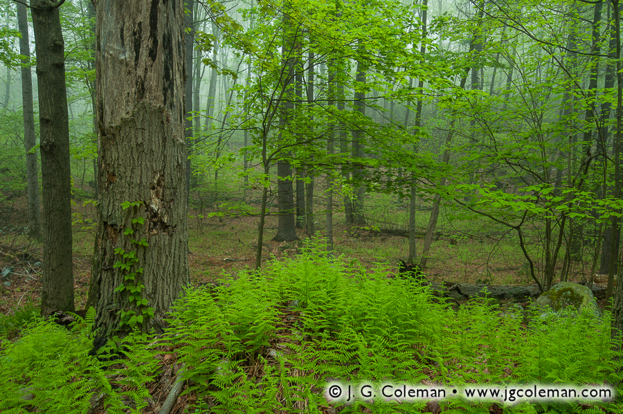
Whittemore Sanctuary, Woodbury, CT
© 2012 J. G. Coleman
Originally, these woodlands were owned by a private corporation… a scenario which can too often lead to natural places vanishing in a flurry of development and subdivision when it comes time to liquify some assets. Luckily, beginning in 1965, the land was leased to the Flanders Land Trust which, at that time, was a fledgling non-profit organization bringing fresh ideals of open space preservation to western Connecticut. Who would’ve thought that by 2012, after nearly five decades of tireless work, the Flanders Land Trust would have preserved 2,000 acres of land throughout Woodbury, Middlebury, Southbury and Bethlehem? As it would happen, the trust ultimately managed to pull together the funds to buy all of the woodlands that are now Whittemore Sanctuary, ensuring that scenes like those pictured in “Whittemore Woods” will last into perpetuity.
- Be sure to visit my online galleries to see more recent work from Whittemore Sanctuary.
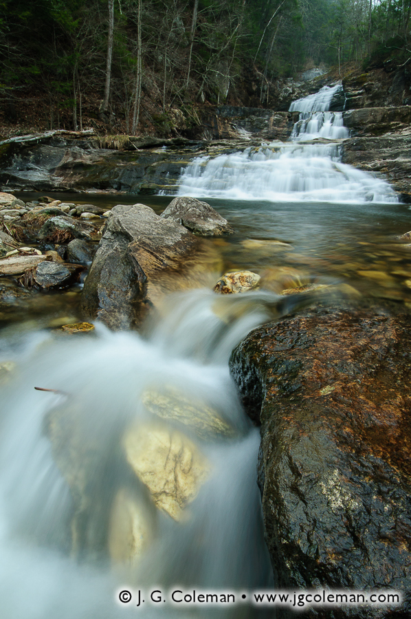
Pine Brook Preserve
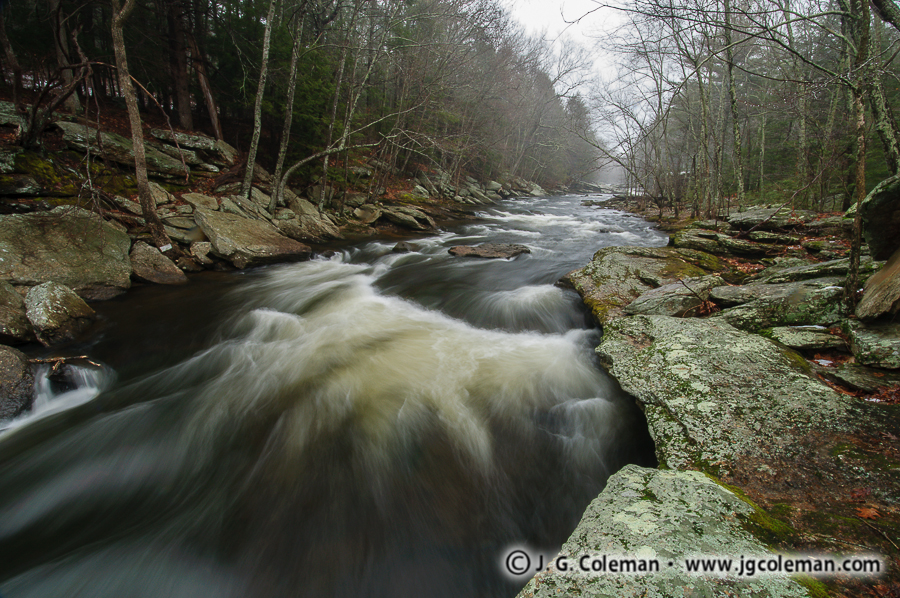
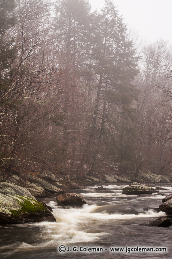
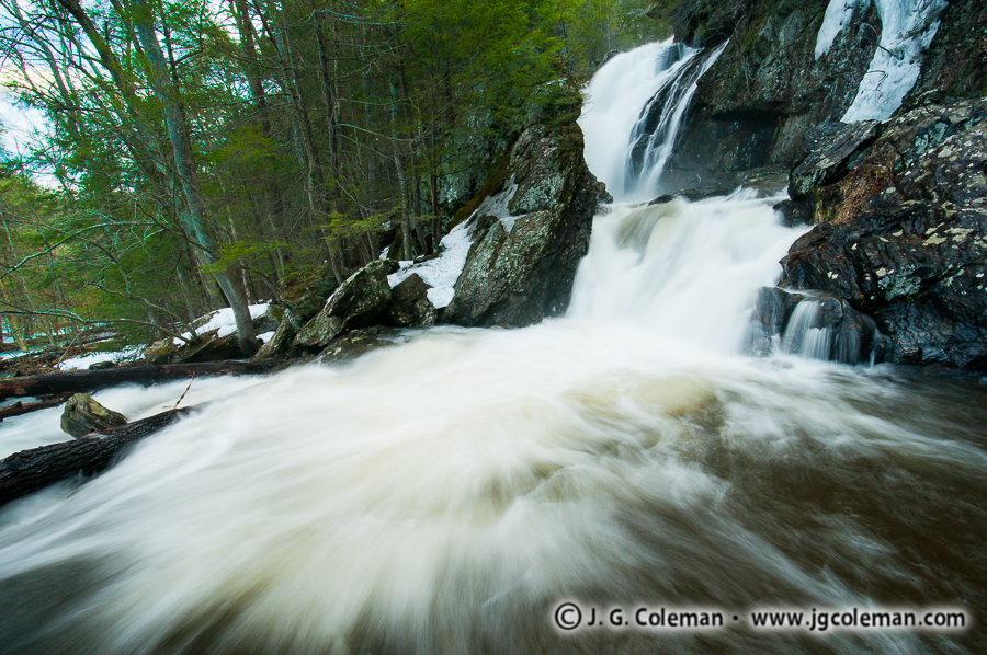
Another of my new releases, “Down on Pine Brook”, brings us 40 miles west of Whittemore Sanctuary to the banks of Pine Brook as it wanders through the forests of Haddam Neck. Our eyes can move effortlessly through this piece, beginning with picturesque cascades in the foreground where Pine Brook struggles furiously against the resistance of boulders. On the opposite bank of the river, sunlight filters through a dense canopy and floods the crowded forest understory in green-tinted light. The course of Pine Brook recedes far into the distance, its surface punctuated by boulders and marbleized with wispy, whitewater riffles.
Pine Brook Preserve, Haddam, CT
© 2012 J. G. Coleman
Over 20 acres of this intimate riverscape are preserved under the auspices of the Haddam Land Trust, another of Connecticut’s many land conservation organizations that work tirelessly to ensure that nature will have a profound presence in the Nutmeg State well into the distant future. But if we follow the waters of Pine Brook after they leave the boundaries of the land trust preserve, a larger story of cooperative land preservation reveals itself. The “Salmon River Division” of the Silvio Conte National Wildlife Refuge actually abuts Pine Brook Preserve and protects hundreds of acres of land beside Pine Brook for the remaining mile of its course, right up until it empties into the larger Salmon River. Now carrying the waters of Pine Brook, the Salmon River continues a southward journey towards the Connecticut River, first making a wide bend around the 300-acre Machimoodus State Park in East Haddam. Less than two miles further south, the Salmon River eventually empties into the Connecticut River. In this relatively small stretch of Conneticut River watershed along Pine Brook and Salmon River, we find the combined land preservation efforts of federal government, state government and a local land trust. This sort of multi-faceted approach to open space is a refreshing development, indeed. Increasingly, local land trusts have sought to acquire properties adjacent those owned by the state and federal government, or even owned by neighboring land trusts, thereby helping to create even larger unbroken tracts of open space which are ultimately more beneficial to wildlife than smaller areas fragmented by roads and neighborhoods.
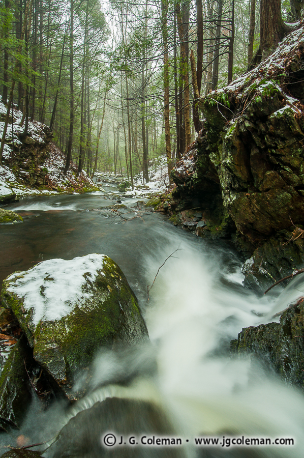
George Dudley Seymour State Park
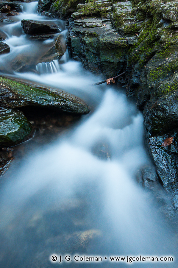
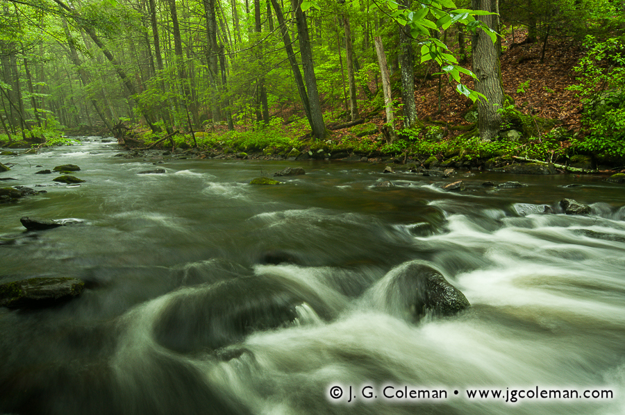
“New England Oasis”, one of my new works from Connecticut’s George Dudley Seymour State Park, brings you to the banks of Axelson Brook at the height of the springtime awakening. A lush patch of ferns and false hellebore lead you to the quiet stream side, where banks lined with moss-laden boulders meander into the depths of brilliant green woodlands.
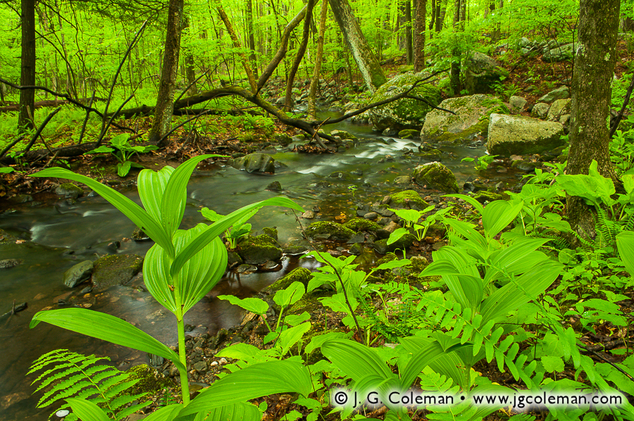
George Dudley Seymour State Park, Haddam, CT
© 2012 J. G. Coleman
Encompassing more than 300 acres of forest and flood plains, George Dudley Seymour State Park lies on the eastern side of the Connecticut River in Haddam. Interestingly, within a system of over a hundred Connecticut state parks and forests, it is among a small handful named explicitly after a person. George D. Seymour was born in the mid-1800’s and, while still only in his twenties, he had achieved such success as an attorney that he was able to channel some of his resources into preserving land. He even set up a foundation which has continued making contributions to open space preservation up to the present day. Through his personal contributions of land, and the on-going efforts of his trust since his passing, Seymour “acquired all or part of seven other state parks” in addition to the full acreage of the park that now bears his name.
Another of my new pieces from George Dudley Seymour State Park, titled “The Clark Ruins”, features a long-abandoned stone foundation quietly being reclaimed by nature in the misty gorge of Axelson Brook. While it’s unclear who built the old structure or exactly what purpose it served, chances are that it would’ve been familiar to the Clark family.
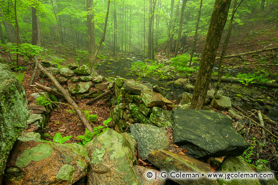
George Dudley Seymour State Park, Haddam, CT
© 2012 J. G. Coleman
Comprised of three brothers, the Clark family operated a rather successful business in Connecticut producing a range of agricultural equipment from the 1870s through the early 1900s. During much of that time, the family lived on the land that is now George Dudley Seymour State Park. In those days, however, it was named “Clarkhurst” and essentially functioned as the Clark’s private estate. One can only imagine that Clarkhurst would’ve been a magnificent homestead in its hey-dey, a generous swath of land where the Clark brothers and their families could enjoy their private slice of the countryside while rising each morning to spectacular views of the Connecticut River. But those days came and went long ago. One of the brothers, Henry, ultimately bought out his siblings and became the sole owner of the land, only to pass away in 1914 and leave the property to his daughter. She tried to maintain the extensive estate, even developing it as a golf course for some time, but it seems that these efforts simply didn’t work out as planned. By the time the 1930s rolled around, the various structures on property were falling into a state of disrepair and it was clear that Clarkhurst was beginning to succumb to the rigors of time. For another three decades, the property continued to deteriorate from its former glory, changing hands at least once along the way. By 1960, the George Dudley Seymour Foundation had come to recognize the value of the property as parkland and provided funding to help the Connecticut Forest and Park Association buy the old estate grounds. And so it was that this land, once a glorious private estate over a century ago, came to be George Dudley Seymour State Park: a place of natural beauty for the enjoyment of all.
Every time I’ve visited the state park, I’ve somehow found myself entirely alone there. Sometimes, as I pause for a quiet rest along the trails, I try to imagine what this place must have been like so long ago. I try to envision the Clark brothers standing on the riverbanks of Clarkhurst in the 1880s, secure in their achievements as they overlooked the wide breadth of the Connecticut, with the sun slowly sinking behind the hills that rise from the opposite shore and the sky rendered a glowing twilight canvas of wispy pastels. How timeless must such a moment have felt to them? How solid and permanent must their modest empire have seemed? Surely, they could never have imagined that, generations later, their buildings would be reduced to crumbling foundations, their estate would be bristling with forests and meadows, and some lone photographer would walk quietly through the remains in a world that would hardly be recognizable to them. It’s precisely that nostalgic feeling that I sought to capture with “The Clark Ruins”. On one hand, a pang of regret that those things which are important to us are always fleeting. On the other hand, a sense of renewal not unlike that of the springtime… a sense that loss is part of nature’s glory and that a renewed vitality is always just around the corner.
- Be sure to visit my online galleries and see more of my fine art photography from Haddam’s George Dudley Seymour State Park.