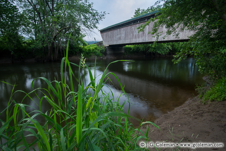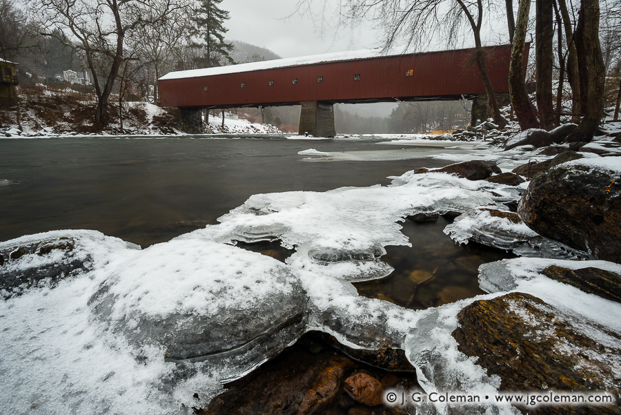
West Cornwall Covered Bridge, Cornwall, Connecticut
© 2016 J. G. Coleman
A jacket of snow-dusted ice clings to shallow boulders along the banks of the Housatonic River in Connecticut’s Northwest Hills. Further upstream, against a backdrop of foggy woodlands and steep hills, a long covered bridge faithfully spans the frigid gorge.
At more than 170 feet in length, the West Cornwall Covered Bridge is arguably the most impressive bridge of its type left in Connecticut. Given the cost of maintenance and increasingly heavier loads it was forced to endure since the mid-1800s, it’s nothing short of a miracle that the bridge has survived to the present day.
There were low points along the way, of course. In 1945, a tanker truck broke through the bridge floor and crashed into the river below. A couple decades later in the late 60s, state officials contemplated tearing it down, but were met with vehement opposition from the surrounding community. Instead, it was reinforced with carefully-hidden steel underpinnings, ensuring the bridge would stick around for several more generations to come. The project was a marvelous success, even earning Connecticut an award from the Federal Highway Administration for exemplary historic preservation.
Purchase a Fine Art Print or Inquire About Licensing
Click here to visit my landing page for “A Crossing in Wintry Repose” to buy a beautiful fine art print or inquire about licensing this image.