When I’m out shooting in the field, I don’t always know for certain how well a given image is going to “work” once I get it back home and start developing it and reflecting upon how well it does or doesn’t fulfill my creative vision. There are times when I find myself in beautiful environments which simply prove too difficult to commit to a two-dimensional composition in a way that’s faithful to my creative expectations. After all, there are all sorts of sensory experiences that contribute to our experience in the outdoors: birds chirping, changing light, clouds drifting overhead, the sound of breeze rushing through the forest canopy, maybe a brisk autumn chill in the early morning or the impressive quietude during a snowfall. Now, there are techniques that can be leveraged to suggest some these qualities in a purely visual, flat image, but there’s no way to truly reproduce them. And sometimes, when those supporting elements are lost, the visual impression that remains just doesn’t quite convey what I’d hoped it would.
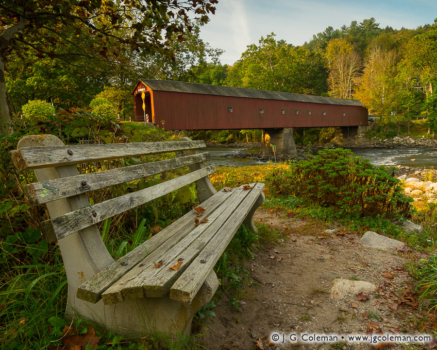
But then again, there are also some outings during which everything comes together beautifully and I know the moment I release the shutter that the imagery I’m producing resonates decisively with my creative vision. “I Dreamt of the Housatonic”, my latest release which I produced last autumn, was created under just those sort of circumstances. When I came by this weathered bench overlooking the Housatonic River and West Cornwall Covered Bridge with soft morning light imparting a gentle glow, it immediately struck me as a golden opportunity.
Having meditated over what drew me so strongly to the scene, it’s tough to pin down any one facet. The image, to me, has a timeless feel that is largely removed from immediate associations with modern life. No cars, no houses with satellite dishes, no joggers in Under Armor, no power lines lazily draped across the river. Putting aside the fact that it’s clearly a modern color photograph, the scene could just as easily have looked almost identical to an observer in 1900 as it did in 2017 (okay, okay… maybe metal road signs weren’t as common back then, but you get my point). And to my sensibilities, that timeless quality also contributes to a somewhat dream-like feel: as if we might find ourselves whisked away in a blissful dream to this quiet bench in the countryside, enjoying the amaranthine solitude of a peaceful, rustic riverscape.
Purchase a Fine Art Print or Inquire About Licensing
Tucked away in the far northwestern corner of Massachusetts, Mount Greylock State Reservation deserves special acclaim. For one thing, the park encompasses nearly 20 square miles of territory in Berkshire County, ranking it among the largest parks in Southern New England. And for that matter, Mount Greylock itself is the highest mountaintop in Massachusetts at 3,489 feet. Visitors can take in views of five states from its summit or hike any of the 70 miles of trails that weave up and around the mountain slopes. Everything about this park exists on a much larger scale than what we’re generally accustomed to in New England’s relatively crowded southern states.
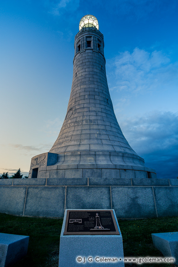
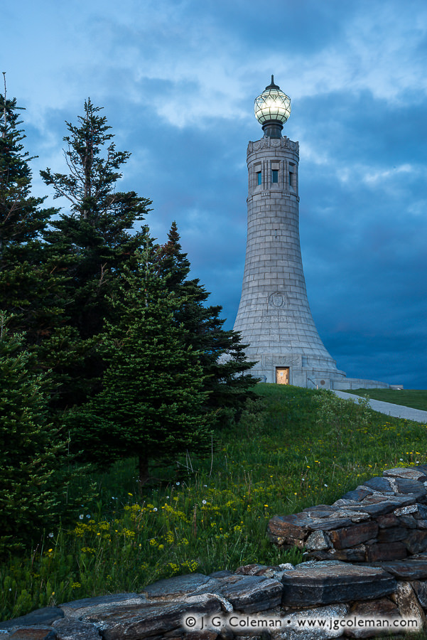
I could go on and on about Mount Greylock in general, but my focus in introducing my piece, “Faithful Even Unto Death”, is the Veterans War Memorial which stands atop the mountain summit. Built in 1933 to honor the soldiers of World War I, the beautiful 93-foot granite tower looks like some ancient, mythologized lighthouse that you might awe over in a history book. Indeed, just like a maritime lighthouse, a large globe at the monument’s peak glows throughout the night and is said to be visible from the surrounding hills up to 70 miles away. And for the curious minds out there, the name of my image is excerpted from an inscription on one of the memorial plaques which says of the fallen soldiers that “they were faithful even unto death”.
Purchase a Fine Art Print or Inquire About Licensing
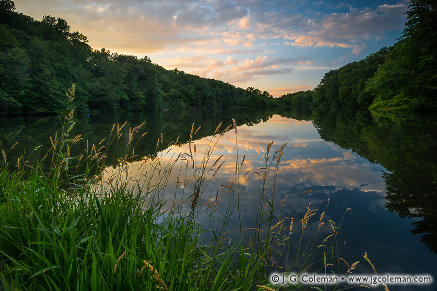
In my piece, “Becalming Birge Pond”, colors streak across a sunset sky over Central Connecticut as the first day of summer comes to a close on the mirror-like waters of Birge Pond.
Centuries-old ponds and waterfalls that once powered streamside mills are quite prevalent in my work, especially because most have long-since been retired from serving industrial purposes and blossomed into places of natural beauty. Birge Pond may have had similar origins and enjoys a similar golden era in its “retirement”, but its final stint of commercial use in the early 1900s was of a sort that has largely been forgotten in modern times. Consider that, prior to electric refrigerators becoming a widespread appliance, cooling food or drink during the warmer months of the year meant storing it in an insulated icebox beside a brick of ice. But if there weren’t refrigerators in homes, and if ice couldn’t be produced using industrial freezers, then how in the world did folks find ice for their iceboxes in the middle of the summer?
Birge Pond was one of many long-standing “ice ponds” across Connecticut which, once naturally frozen in the wintertime, would be harvested of its ice. The large, quarried ice blocks would then be tucked away in spacious barns to be stored and eventually sold throughout the coming year. Proper ventilation and generous packings of hay for insulation were actually so effective that some ice houses, such as the Southern New England Ice House that operated on Birge Pond, could reportedly keep ice for up to a couple years after harvest!
The industry of harvesting and selling ice was so essential and so ubiquitous in those earlier days that it probably seemed as if it’d be around forever. But as innovators worked through various ways to incorporate refrigerants into early designs of “electric iceboxes”, everything began to change. The Southern New England Ice House on Birge Pond was shuttered in 1933 and torn down shortly afterwards. Refrigerators became commonplace by the 1940s and ice harvesting, a widespread and commonplace industry just a few decades earlier, was relegated to the history books.
Purchase a Fine Art Print or Inquire About Licensing
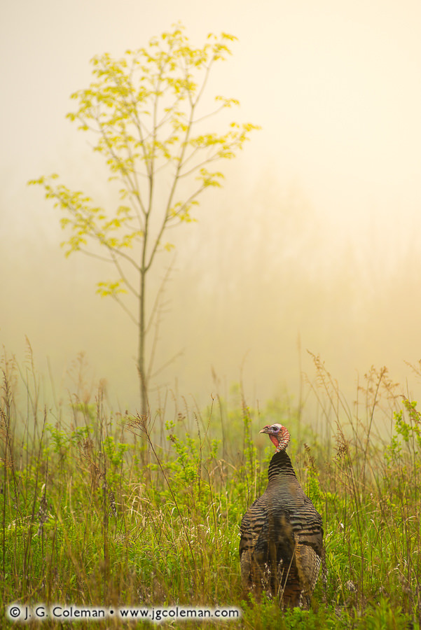
It’s rare that I have an opportunity to photograph turkeys, as they aren’t fond of allowing me to approach close enough to use a 200mm lens (the longest I typically carry for landscapes). It’s even rarer that they’re still enough and my hands steady enough for a sharp, handheld exposure as was the case with my new piece, “Náham”. That there happened to be a beautiful, solitary sapling in this meadow roughly aligned with the turkey was the icing on the proverbial cake. Sometimes everything just falls into place.
If you’re curious, “náham” was the term for ‘turkey’ in the language of the Mohegan natives, whose ancestors were living in the territory of present-day Connecticut at least as early as the 1500s. There was something about this close encounter with a wild turkey in a quiet, misty field that felt uniquely timeless, as if the exact same perspective could just as easily have been available to tribesmen of times long past. Using the ancient Mohegan word for this equally ancient, native bird seemed a most fitting choice.
Purchase a Fine Art Print or Inquire About Licensing
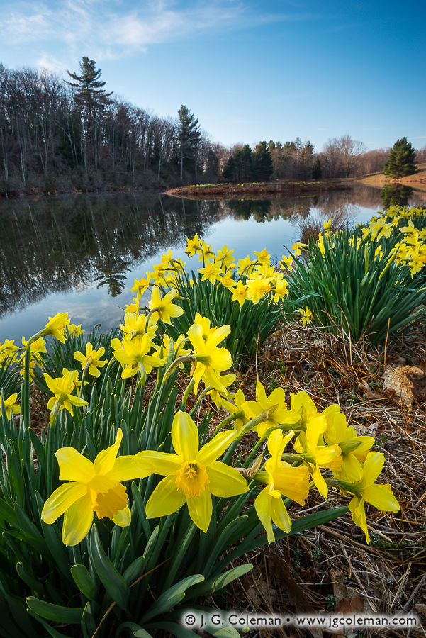
There is perhaps no surer a sign that proper springtime weather has arrived than the emergence of daffodils throughout Connecticut. From town parks to yard gardens, by late April it seems that you can scarcely take a short drive anywhere in the state without seeing clusters of these showy jewels swaying about. But in two spots especially -Meriden’s Hubbard Park and Litchfield’s Laurel Ridge- the immense plantings of daffodils are truly a springtime spectacle.
Hubbard Park can undoubtedly lay claim to the most expansive fields of daffodils, for some 600,000 push through the soil each year. And remarkably, it all started with an initial planting of just 1,000 bulbs in 1949. Over the years, more were planted regularly and established bulbs continued to multiply. By 1979, with Hubbard Park already well-known for its April flower display, the city of Meriden established the annual Daffodil Festival which attracts crowds every year from well beyond the city.
But in 1941, a handful of years before Hubbard Park got its first daffodils, bulbs were already being planted along Laurel Ridge in the Litchfield Hills some 20 miles to the northwest. And while the planting on Laurel Ridge probably can’t boast quite the same volume of daffodils as Hubbard Park (I can’t find an estimate anywhere), I can say from experience that there are more than enough to impress and some might find the quiet, bucolic setting of Laurel Ridge to be a welcome bonus.
Purchase a Fine Art Print or Inquire About Licensing
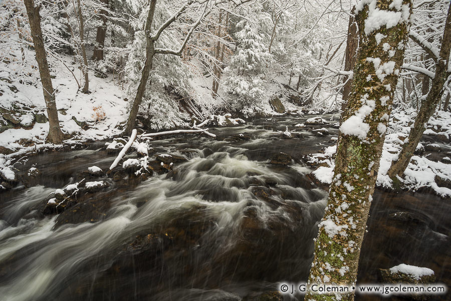
“The birds have a right to complain of misplaced confidence, and so have we, since the blandness of spring the day before deluded us into regarding her intentions as honourable,” wrote Charles Whiting in 1903, lamenting a springtime snow in New England not so different from the one we endured a few days ago here in Connecticut. Indeed, one could scarcely discern this April vista of Roaring Brook from wintry visions of a January blizzard.
But even Whiting had to concede a certain admiration for the waning wiles of winter. “It was really very beautiful snow, and whether dissipating in the sunshine or shining in the moonlight, it was several degrees whiter than the average. Less meteoric dust in it. Spring snow always looks so very young, and it is a blessing to the new grass and young grain,— one of those blessings that brighten as they take their flight.”
Purchase a Fine Art Print or Inquire About Licensing
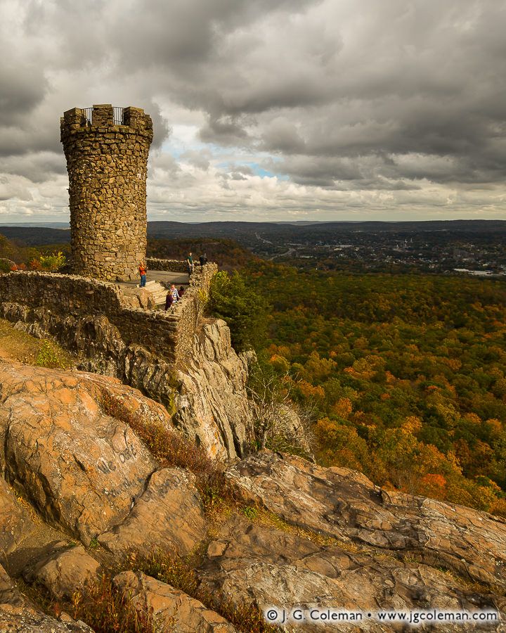
Castle Craig, rising from the rampart cliffs of the Hanging Hills, is an enduring curiosity in New England’s largest municipal park. The stone tower was built over a century ago to resemble a medieval castle turret, crenels and all, and sits perched on a prominent cliff high above the city of Meriden. Surely a good deal of its local fame is derived from its visibility, for it can be seen from miles away in countless places from the surrounding valleys. It’s also a unique link to Connecticut’s roots as a manufacturing hub, its construction funded by wealthy-industrialist-turned-philanthropist Walter Hubbard just as America’s Gilded Age came to a close. He offered it free-of-charge to the people of Meriden along with a whopping 1,200 acres of woodlands and grounds landscaped by the Olmsteads.
There’s much that can be said of Castle Craig and the surrounding parklands, but the tower poses a bit of a mystery for modern-day visitors: what of it’s odd name? How did Castle Craig become “Castle Craig” even though its not really a castle? And who was Craig?
Interestingly, a 1901 article mentions “the tower just completed in Hubbard Park, on Castle Craig of the Hanging Hills of Meriden”, suggesting that the mountain top itself was named Castle Craig, not the tower. And indeed, many writings published in the first few decades of the 20th century refer to “the Castle Craig tower” rather than referring to the tower itself as Castle Craig (even Meriden’s official website refers to it as such).
So, in what may seem like an unlikely twist, the tower we know today as “Castle Craig” appears to have actually inherited that name from the peak on which it was built. And it probably wouldn’t be too much of a stretch to imagine that old Hubbard hatched the idea for a castle-like tower on that mountain promontory precisely because it was already named Castle Craig to begin with.
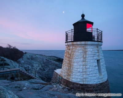
As far as I can tell, the Castle Hill Lighthouse was designed to look castle-like because it was being built on a place that had been named Castle Hill for years already.
This wouldn’t be the first time that such a thing happened in New England, either. A few years ago I had the pleasure of photographing the Castle Hill Light, a lighthouse built in 1890 overlooking Narragansett Bay on the Rhode Island coast. There’s no doubt that the Castle Hill Light was constructed to look castle-like, with rough-cut granite blocks of assorted sizes expertly fit together to form a squat tower. I wrote about that beacon in August 2016:
“Bearing certain resemblance to the turret of some medieval fortress, one could be forgiven for mistakenly assuming that Newport’s Castle Hill Lighthouse lent its name to the hill rising inland from its rocky, oceanfront perch. As it happens, though, the modest knoll beside Narragansett Bay was called Castle Hill at least as early as the 1860s, decades before the first of the lighthouse’s granite blocks were laid (perhaps it was the hill’s name that inspired the lighthouses design?).”
Who would’ve thought?
Perhaps the next logical question is how a mountain summit comes to be named after a castle. Maybe it takes a bit of imagination, but it has by no means been unusual over the centuries for prominent mountains or peaks to be likened to castles and named as such. Castle Peak, a mountain nestled in California’s Sierra Nevada, is so named for its natural, tower-like rock outcroppings. Then there’s Castle Mountain in the Canadian Rockies, the cliffs of which possess natural horizontal markings that give the impression of courses of granite blocks as would be seen in castle walls. That a traprock cliff which rises high and mighty above the City of Meriden might be likened to a grand castle edifice is certainly believable, even if not explicitly stated in any writings I can find.
So we’ve established that the mountain summit itself is the “real” Castle Craig, even if that name has long since been usurped by the tower. And we’ve seen that there’s precedent in likening mountains or mountain peaks to medieval castles. But that still leaves one question: who was Craig and why did he get a mountain top named after him?
What records I can find offer no insight into that question. Books and articles published around 1900, shortly after a winding mountain road leading to Castle Craig was completed as part of Hubbard Park, describe the peaks of the Hanging Hills as having been very rugged and difficult to access in prior years. It’s probable that Castle Craig was only very rarely visited before Hubbard built a mountain road that offered easy access. Before then, it was likely a somewhat obscure peak which wouldn’t have warranted mention in writings of the time. Consequently, I can only offer speculation here. As others have theorized in the past, the name “Castle Craig” probably wasn’t derived from a family of Craigs. Instead, it seems more feasible that it was a minor corruption of an earlier name: “Castle Crag”. We tend not to use the term ‘crag’ much these days to describe boulders or rocky peaks, but it was part of the common lexicon in the 19th century (Google’s Ngram Viewer suggests that ‘crag’ occurred an average of about 4 or 5 times more often in writing during the 1800s than it does now).
Purchase a Fine Art Print or Inquire About Licensing
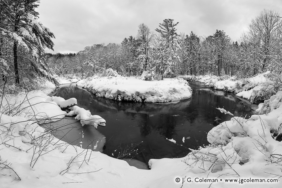
The Hollenbeck River winds lazily through peaceful woodlands clothed in the heavy snow left by a vicious March Nor’easter.
Historians and linguists have debated the origin of the term “Nor’easter” for decades. All can agree that Nor’easters are storms which usually arise during winter and rake the Eastern seaboard with winds gusting from the northeast. But what can be said about the peculiar spelling of this term?
“Nor’easter” may seem, at face value, to be a phonetic spelling of “Northeaster” as it would be spoken with some New England accent. Indeed, the implication is that this spelling is an authentic product of New England society. But it is the omission of ‘r’ sounds that really characterizes coastal accents of Massachusetts, Maine and Rhode Island, so that doesn’t quite add up.
Surprisingly, research suggests that this bizarre spelling predates New England altogether, with “noreast” being found in English texts dating back as far as the late 1500s!
Purchase a Fine Art Print or Inquire About Licensing
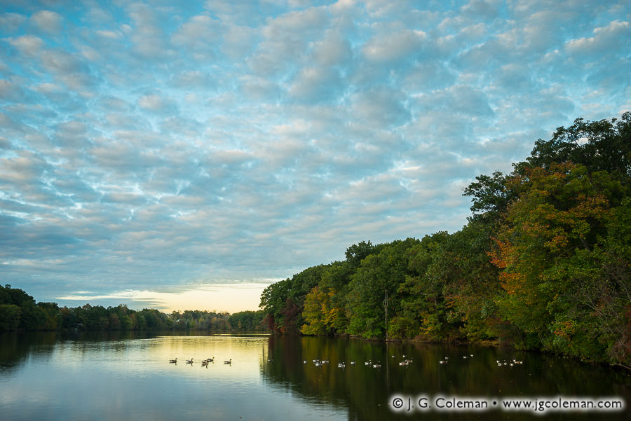
As the sun sinks low on the horizon during a balmy October evening, Union Pond grows hushed and geese drift about upon scintillant reflections.
In his 1830 book, Connecticut Historical Collections, author J. W. Barber said of Manchester that the “first cotton mill … successfully put in operation in Connecticut, was erected within the present limits of this town in 1794, and owned by Messrs. Samuel Pitkin & Co.” By the 1860s, the millworks had been renamed the Union Manufacturing Company and the operation of its machinery demanded an ever greater volume of waterpower. That meant damming the Hockanum River in 1866, creating a millpond that we know today as Union Pond, after the company it once served.
The mill was shuttered by the turn of the century and Union Pond was repurposed in 1901 to feed a hydropower plant nearby. In time, though, even that endeavor grew obsolete with the rise of the modern power grid. What we’re left with today is a Union Pond which has been appointed to a more relaxed post: serving as the centerpiece of a scenic park in what has now become the Union Village Historic District.
Purchase a Fine Art Print or Inquire About Licensing
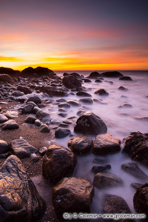
I’ve said it before and I’ll say it again: it’s hard to beat shooting the Connecticut coast during wintertime. Many of the coastal elements that I’m interested in working with as a landscape photographer are unchanged whether it’s 35° F or 85° F, whether I’m shooting in short sleeves or bundled beneath three layers. There’s one big difference, though: when those cold winds are blowing I usually have the place to myself… an opportunity which is rare at most of Connecticut’s popular state park seashores during warmer weather!
I produced this piece, “Winchester Lately”, just this past weekend during a cold January morning. But let’s face it: if I told you this had been taken in August, you’d have no reason believe otherwise, right?
Purchase a Fine Art Print or Inquire About Licensing
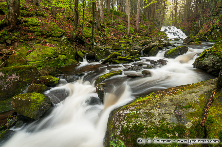
Bunnell Brook crashes over a waterfall in the distance, roiling itself into a whitewater frenzy and charging forth through the verdant woodlands in the hills of Burlington.
Many of Connecticut’s waterfalls were named long ago when they were at the heart of streamside mills driven by waterwheels or turbines. Some folks may have appreciated the natural beauty back then, but most probably knew them as busy places of industry where goods were churned out and livings were made. And in some cases, once those mills vanished and the waterfalls ceased to be places where livelihoods were earned, the names and stories behind each could become quite jumbled and obscure in just a generation or two.
Take the case of Bunnell Brook in Burlington, where there are two distinct waterfalls found about 600 feet apart. We know that one of the two waterfalls was historically called “Bunnell’s Falls”, but which one? An 1895 publication suggests it was the lower falls, though more recent publications tend to apply that name to the upper falls (which are seen in this piece). I don’t know who’s right, but in the meantime, I’ll just stick to Upper and Lower Burlington Falls.
Purchase a Fine Art Print or Inquire About Licensing
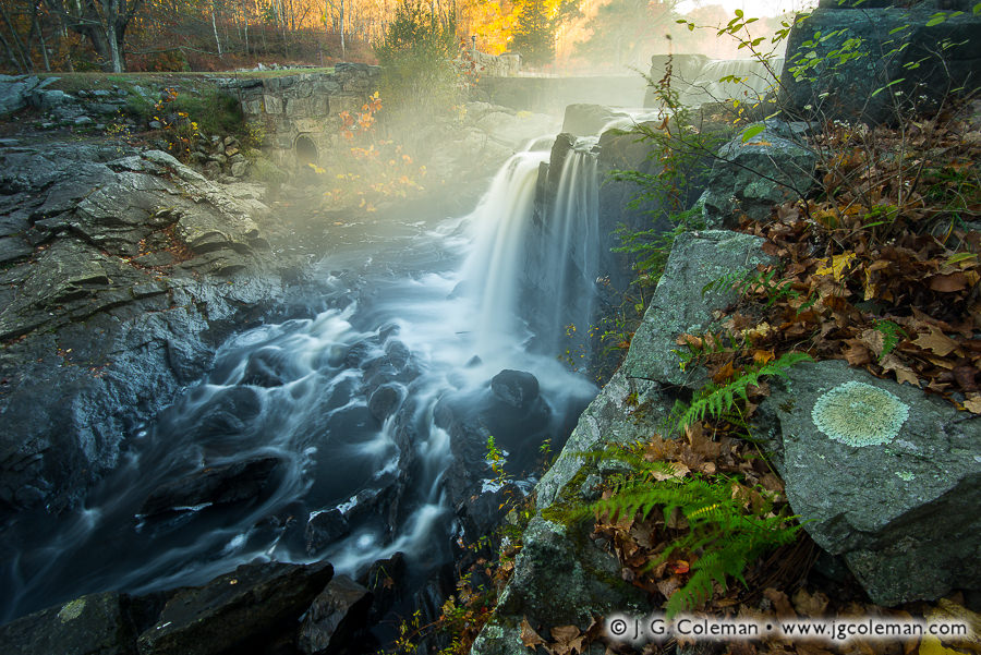
Cold shadows and the warmth of dawn coalesce at Southford Falls, where Eightmile Brook leaps from an old mill pond and stages a vigorous charge through the dark gorge below.
Although I produced this image back in late October of 2017, just as autumn colors were reaching their modest peak last year, it wasn’t until yesterday evening that I managed to process all of my work from that shoot. That’s pretty typical of my autumn imagery each year, the bulk of which tends to be processed only after colder weather takes hold. Why such a long turnaround? Well, the colorful stretch of autumn that we all hold dear generally spans just 5 or 6 weeks; it’s gone just as fast as it arrives, so I need to work quickly. That leaves scant time for sitting in front of a computer tweaking development controls.
I generally dedicate my time during autumn almost exclusively to field work right up until “stick season” sets in. Not familiar with “stick season”? It’s basically the second half of autumn -after the trees have lost their leaves but before winter snows have arrived- when the entire landscape looks like a mess of bare sticks reaching into the sky.
Purchase a Fine Art Print or Inquire About Licensing