Categories
All Things Connecticut New Print Releases The American Northeast

An Orchard Older than the Nation

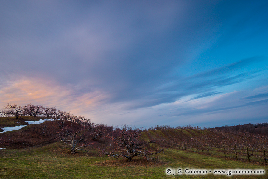
Yankee Farmlands № 54 (Apple orchard, Middlefield, Connecticut)
“Yankee Farmlands № 54”
Apple orchard at sunset, Middlefield, Connecticut
© 2016 J. G. Coleman

Rolling hills bristling with apple trees are immersed in shadow as sunlight gently begins to slip from the Connecticut Valley. Snows from a recent storm cling stubbornly to a nearby hillside and the sky is smudged with swirling color as clouds drift overhead.

For a few reasons which I won’t discuss right now, I’ve generally refrained from naming the specific farms that are seen in my Yankee Farmlands project. But Lyman Orchards, which encompasses the apple trees seen in this piece and more than 1,000 surrounding acres, is truly deserving of some special attention.

This orchard is so old, it actually predates the United States. That’s right: it began on a modest 32 acres back in 1741, decades before the American Revolution. As if that alone isn’t fairly impressive, consider that the 275-year-old Lyman Orchards has been owned and operated by the Lyman Family since the very beginning. Today’s eighth-generation owners are hopeful that a ninth-generation of Lymans will step forward to continue this remarkable legacy well into the 21st century.

Purchase a Fine Art Print or Inquire About Licensing

Click here to visit my landing page for “Yankee Farmlands № 54” to buy a beautiful fine art print or inquire about licensing this image.

Want to See More?

Be sure to check out all of my work in my on-going Yankee Farmlands project.

Categories
All Things Connecticut New Print Releases The American Northeast

A Crossing in Wintry Repose

A Crossing in Wintry Repose (West Cornwall Covered Bridge, Cornwall, Connecticut)
“A Crossing in Wintry Repose”
West Cornwall Covered Bridge, Cornwall, Connecticut
© 2016 J. G. Coleman

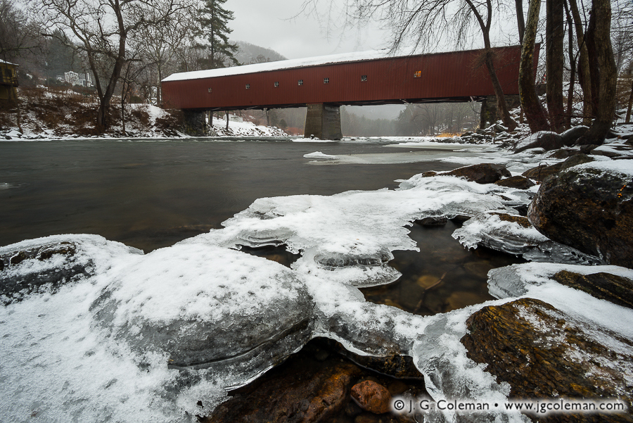
A jacket of snow-dusted ice clings to shallow boulders along the banks of the Housatonic River in Connecticut’s Northwest Hills. Further upstream, against a backdrop of foggy woodlands and steep hills, a long covered bridge faithfully spans the frigid gorge.

At more than 170 feet in length, the West Cornwall Covered Bridge is arguably the most impressive bridge of its type left in Connecticut. Given the cost of maintenance and increasingly heavier loads it was forced to endure since the mid-1800s, it’s nothing short of a miracle that the bridge has survived to the present day.

There were low points along the way, of course. In 1945, a tanker truck broke through the bridge floor and crashed into the river below. A couple decades later in the late 60s, state officials contemplated tearing it down, but were met with vehement opposition from the surrounding community. Instead, it was reinforced with carefully-hidden steel underpinnings, ensuring the bridge would stick around for several more generations to come. The project was a marvelous success, even earning Connecticut an award from the Federal Highway Administration for exemplary historic preservation.

Purchase a Fine Art Print or Inquire About Licensing

Click here to visit my landing page for “A Crossing in Wintry Repose” to buy a beautiful fine art print or inquire about licensing this image.

Want to See More?

Be sure to check out all of my work from the West Cornwall Covered Bridge and surrounding stretches of the Housatonic River.

Categories
All Things Connecticut New Print Releases The American Northeast

Snows Fall over West Simsbury

Yankee Farmlands № 53 (Simsbury, Connecticut, USA)
“Yankee Farmlands № 53”
February snowstorm descends upon windswept farmlands
Simsbury, Connecticut
© 2016 J. G. Coleman

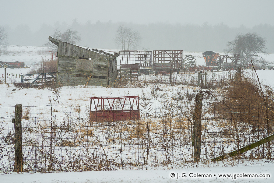
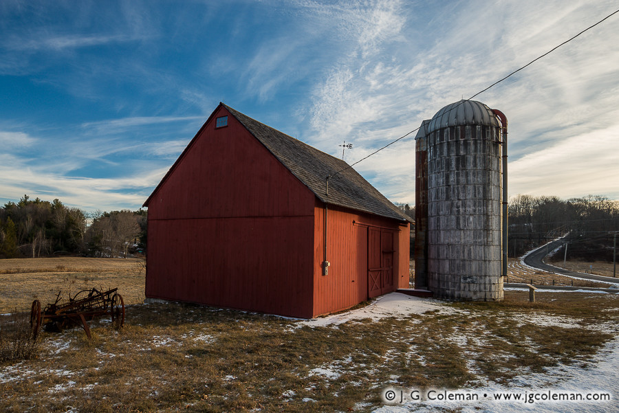
Winter snows descend upon the farmlands of Northern Connecticut, blanketing hay wagons and a time-worn pasture shelter. Bare shade trees dot the landscape beyond, eventually giving way to the hazy silhouette of distant woodlands.

At first glance, snow-laden farms may seem rather dormant: tractors sit parked, fields lay barren and barns slumber away the winter. But historically, tireless New Englanders found ways to keep busy on the farm even during the colder months of the year.

With no fields to tend, farmers set off into their woodlots to fell trees which would eventually be used in the springtime to build and repair barns, fences and sheds. Seems like a terrible time for such strenuous outdoor labor, right? Maybe so, but there was an important advantage to this approach: it was far easier to haul heavy timber back to the farm on a sled over the snow than it would be to overload the frame and wheels of a creaky, old wooden cart in the summertime.

Purchase a Fine Art Print or Inquire About Licensing

Click here to visit my landing page for “Yankee Farmlands № 53” to buy a beautiful fine art print or inquire about licensing this image.

Want to See More?

Be sure to check out all of the work in my on-going Yankee Farmlands project, a journey throughout Connecticut’s countryside in celebration of the agricultural heritage of New England.

Categories
All Things Connecticut New Print Releases The American Northeast

Luminous Collinsville

Luminous Collinsville (Dams beside the old Collins Ax Factory, Collinsville, Canton, Connecticut)
“Luminous Collinsville”
Dams at the old Collins Axe Factory, Collinsville, Canton, Connecticut
© 2016 J. G. Coleman

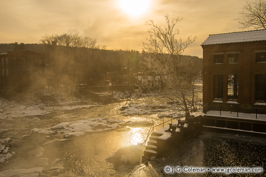
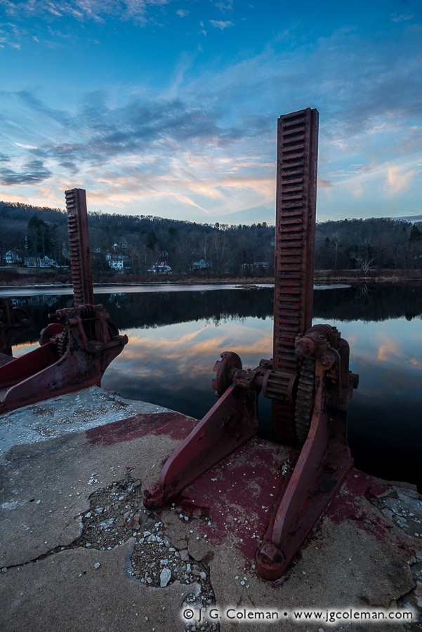
In “Luminous Collinsville” (photo at top), just one the pieces I recently released featuring the historic Collins Ax Factory, mist rises from the Farmington River as it courses through old mill dams in the post-industrial factory town of Collinsville, Connecticut. Stricken by days of brutally cold winter weather, waters behind the spillway are glazed over with ice and snow-capped bedrock punctuates the river below.

Factory Town, Autumn Hush (Old Collins Axe Factory on the Farmington River, Collinsville, Canton, Connecticut)
“Factory Town, Autumn Hush”
Old Collins Axe Factory on the Farmington River, Collinsville, Canton, Connecticut
© 2016 J. G. Coleman

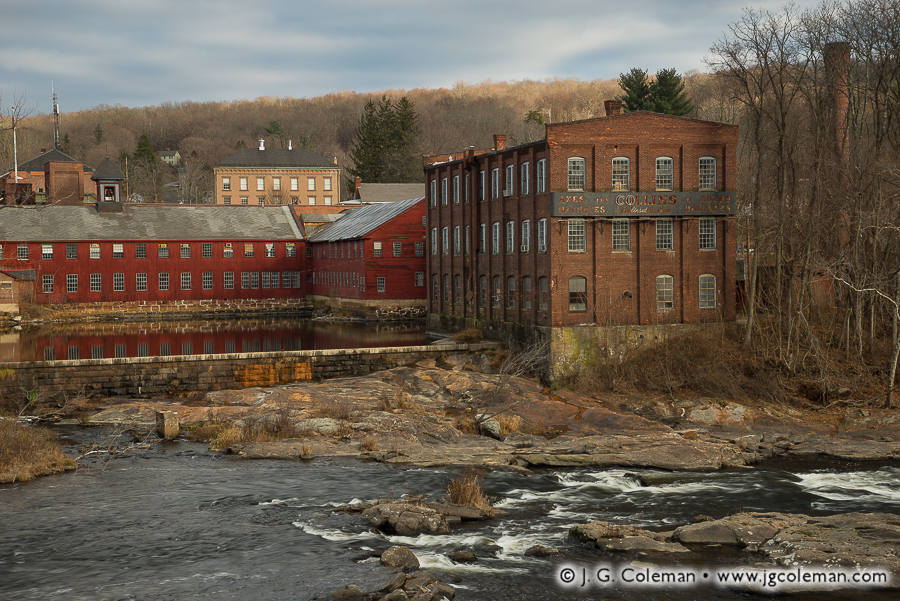
When the Collins Ax Factory opened as a modest mill on the banks of the Farmington River in the 1820s, nobody could’ve predicted the remarkable success that lay ahead. Over the next century, as its fame grew and business soared, the company expanded its facilities at the site, brought in rail lines, built bridges over the river, constructed extensive dams for waterwheels and hydroelectric plants and served as the hub for a community that is still called “Collinsville” to this day. My piece, “Factory Town, Autumn Hush” (above), portrays the main factory building beside a large mill pond.

Gates of Collinsville (Dam regulators at the old Collins Axe Factory on the Farmington River, Collinsville, Canton, Connecticut)
“Gates of Collinsville”
Dam gate hoists at the old Collins Axe Factory on the Farmington River, Collinsville, Canton, Connecticut
© 2016 J. G. Coleman

But even this industrial giant wasn’t immune to changing times. First came the advent of the chainsaw, which diminished the demand for axes. Market competition steadily increased right up until 1955 when a massive flood made matters worse by destroying the rail lines that serviced the sprawling complex. By the 1960s the factory was shuttered, ending a 140-year legacy of continuous operation that turned out millions of the finest axes and machetes that money could buy.

Purchase a Fine Art Print or Inquire About Licensing

Visit my landing pages for “Luminous Collinsville”, “Gates of Collinsville” and “Factory Town, Autumn Hush” to buy a beautiful fine art print or inquire about licensing these images.

Want to See More?

Be sure to check out all of my work from the old Collins Ax Factory and Historic Collinsville.

Categories
All Things Connecticut New Print Releases The American Northeast

Winter in Tobacco Valley

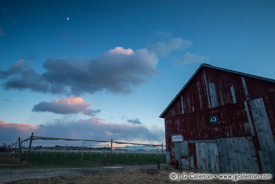
Yankee Farmlands № 52 (Shade tobacco farm, Windsor, Connecticut)
“Yankee Farmlands № 52”
Shade tobacco farm and curing shed, Windsor, Connecticut
© 2016 J. G. Coleman

The moon crests over drifting clouds as night falls on a frigid tobacco farm in the Connecticut Valley. Dormant fields, still months from being planted in the spring, spread far beyond a nearby curing shed clad in worn, mismatched boards.

The town of Windsor, which flanks the western side of the Connecticut River in the northern reaches of the state, represents a particularly unique blend of rural and developed landscapes. Turn the clock back about a century and you would find the area covered over with vast tobacco fields stretching to the horizon in every direction. Once the tobacco market began to steadily decline after the early 1900s, farmers gradually sold off large swaths of surplus cropland.

This gradual shift in land use has resulted in remaining tobacco farms being tightly intermingled with busy roads, corporate office parks and neighborhoods, maintaining an unmistakable presence in the community and hearkening back to earlier days.

Purchase a Fine Art Print or Inquire About Licensing

Click here to visit my landing page for “Yankee Farmlands № 52” to buy a beautiful fine art print or inquire about licensing this image.

Want to See More?

Be sure to check out all of the work in my on-going Yankee Farmlands project.

Categories
All Things Connecticut New Print Releases The American Northeast

They Called It Monakewego

Monakewego (Long Island Sound and Greenwich Point Park, Greenwich, Connecticut)
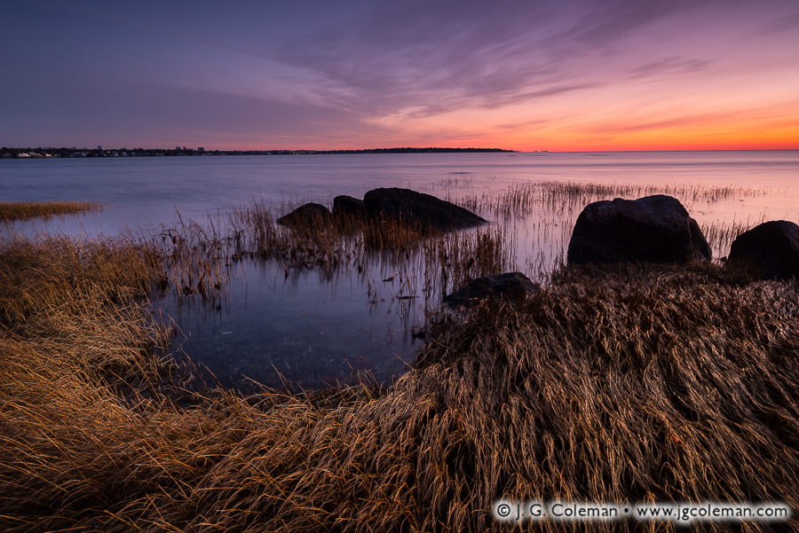
“Monakewego”
Long Island Sound and Greenwich Point Park, Greenwich, Connecticut
© 2016 J. G. Coleman

Beneath pastel skies streaked with soft clouds, the waters of Long Island Sound gently rap at tidal flats and salt grasses of Old Greenwich. To the east, further stretches of the Connecticut coast loom on the horizon against the sublime glow of morning twilight.

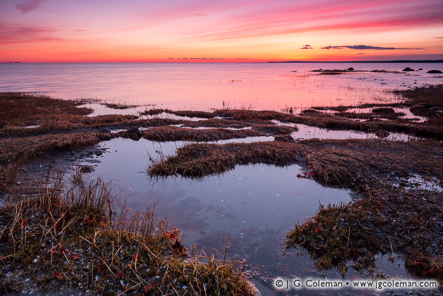
Tod's Clarity (Long Island Sound and Greenwich Point Park, Greenwich, Connecticut)
“Tod’s Clarity”
Long Island Sound and Greenwich Point Park, Greenwich, Connecticut
© 2016 J. G. Coleman

Indigenous people of the Asamuck and Patomuck tribes gave this low-lying peninsula on the west end of Long Island Sound its earliest name: “Monakewego”. If the 17th-century settlers of the Connecticut Colony once knew what that term meant, any record has been lost over the centuries. Throughout the 1700s and early 1800s, the spit of land was part and parcel to a modest community at what is today known as Old Greenwich.

Tod's Labyrinth (Long Island Sound and Greenwich Point Park, Greenwich, Connecticut)
“Tod’s Labyrinth”
Long Island Sound and Greenwich Point Park, Greenwich, Connecticut
© 2016 J. G. Coleman

Throughout those early days, it would’ve been hard to imagine that the influence of New York City, some 20 miles to the west, would eventually swell to such immense proportions that the coastal town of Greenwich and the rest of Connecticut’s Fairfield County would become one of the most affluent places in the nation.

Purchase a Fine Art Print or Inquire About Licensing

Click here to visit my landing page for “Monakewego” to buy a beautiful fine art print or inquire about licensing this image.

Want to See More?

Be sure to check out all of my work from Greenwich Point Park, including all of the photographs seen above.

Categories
All Things Connecticut New Print Releases The American Northeast

Farming on Connecticut’s Rocky Soil

Yankee Farmlands № 51 (Dairy farm, Torrington, Connecticut)
“Yankee Farmlands № 51”
Torrington, Connecticut
© 2016 J. G. Coleman

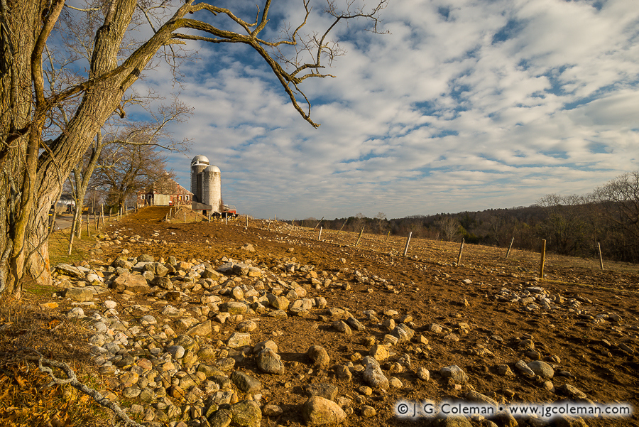
Fences weave through a rock-strewn pasture in the northwest of Connecticut, converging at the crest of the nearby hill crowned with barns and silos. Clouds marble the blue sky overhead, fanning out over the dairy farm and the distant, wooded hills.

“Stones… Connecticut’s state flower!” As a child, I always had a laugh whenever my father related that classic New England joke. Of course, as I grew older and began trying to dig or drive rebar on my own property, the state’s characteristic rocky soil ceased to be a laughing matter. That was especially the case for many Connecticut farmers in earlier times: they toiled endlessly with the burdensome task of hauling stone out of their fields.

For that very reason, agricultural pursuits in particularly rugged areas of the state always tended towards livestock. Since the pastureland used for raising dairy cattle or sheep didn’t have to be plowed, it didn’t demand nearly as much meticulous stone removal.

Purchase a Fine Art Print or Inquire About Licensing

Click here to visit my landing page for “Yankee Farmlands № 51” to buy a beautiful fine art print or inquire about licensing this image.

Want to See More?

Be sure to check out all of the work in my on-going Yankee Farmlands project, a journey through Connecticut’s countryside in celebration of Southern New England’s agricultural heritage.

Categories
All Things Connecticut New Print Releases The American Northeast

Fields ‘neath Talcott

Fields 'neath Talcott (Talcott Mountain and Hublein Tower, Simsbury, CT)
“Fields ‘neath Talcott”
Talcott Mountain (& Hublein Tower) beyond corn field, Simsbury, Connecticut
© 2016 J. G. Coleman

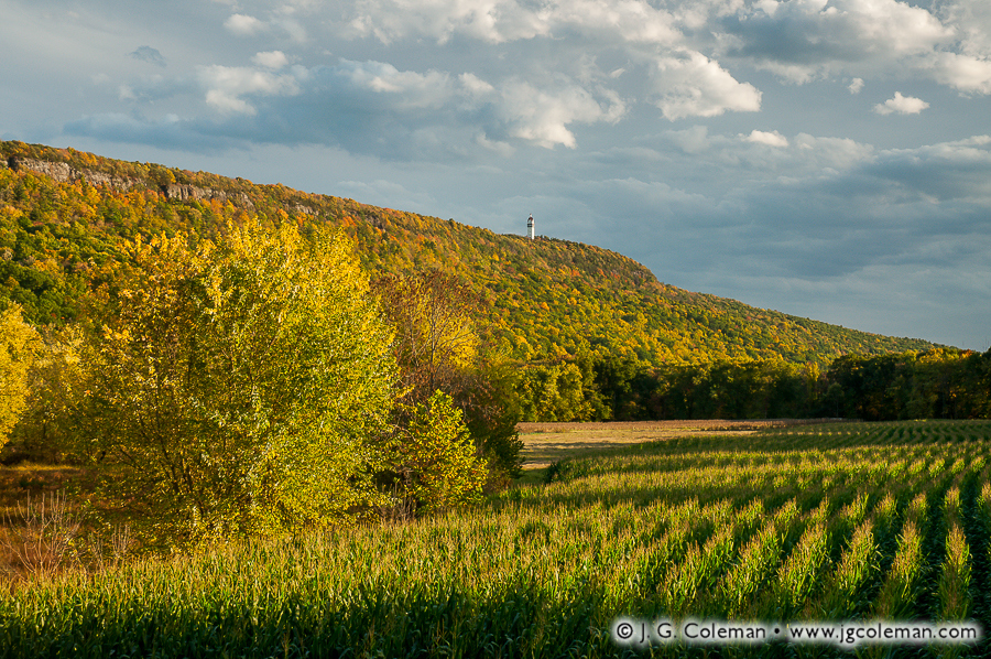
In my latest release, “Fields ‘neath Talcott” (above), long shadows cast from surrounding woodlands reach across rows of corn as the sun sinks low in the sky, signaling the conclusion of a balmy, autumn day. On the horizon, Talcott Mountain rises nearly 1,000 feet from the surrounding countryside; the iconic Hublein Tower crowns the ridge crest, an unmistakable fleck against bold clouds, forest and traprock cliffs.

In 1823, Encyclopedia Britannica summed up Connecticut as “generally broken land made up of mountains, hills and valleys”. Among the rugged features of this landscape is the Metacomet Range, a distinctive chain of long, sheer ridges that weave through the Connecticut Valley.

Talcott Mountain is just one of many prominent summits of the Metacomet Range, which begins near the Connecticut coast and traces a rocky path north for 100 miles up into northern Massachusetts. Some of the more colorfully named mountains in Connecticut’s length of the chain include Sleeping Giant in Hamden and Wallingford, Meriden’s Hanging Hills and the Barndoor Hills in Granby.

Purchase a Fine Art Print or Inquire About Licensing

Click here to visit my landing page for “Fields ‘neath Talcott” to buy a beautiful fine art print or inquire about licensing this image.

Want to See More?

Be sure to check out all of my work from Talcott Mountain and Hublein Tower.

Categories
All Things Connecticut New Print Releases The American Northeast

Winter on the Farms of Enfield

Yankee Farmlands № 50 (Snow on Corn Field, Enfield, Connecticut)
“Yankee Farmlands № 50”
Snow-covered Corn Field, Enfield, Connecticut
© 2016 J. G. Coleman

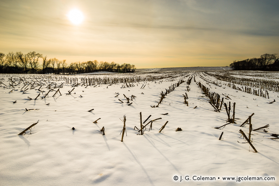
Cast from the lustrous, hazy sky above, sunlight floods a frigid, snow-laden field in the Connecticut River Valley and throws long shadows from the stubble of last season’s corn stalks.

Although modern-day Enfield lies in the northernmost reaches of Connecticut on the east side of the Connecticut River, that wasn’t always the case. An early survey conducted in 1642, just as colonists were beginning to gain a foothold in New England, determined that Enfield was part of the neighboring Massachusetts Colony.

More than five decades later in 1695, a new survey determined that the old boundary between Massachusetts and Connecticut was entirely incorrect. Enfield and a handful of other towns, which had been part of Massachusetts for two generations, were actually part of Connecticut! Things moved slowly in those early days, though: it would take another 50 years before Enfield managed to officially secede from Massachusetts and join the Connecticut Colony in 1750.

Purchase a Fine Art Print or Inquire About Licensing

Click here to visit my landing page for “Yankee Farmlands № 50” to buy a beautiful fine art print or inquire about licensing this image.

Want to See More?

Be sure to check out all of the work of my on-going Yankee Farmlands project, a journey throughout Connecticut’s farmlands in celebration of the agricultural heritage of New England.

Categories
All Things Connecticut New Print Releases The American Northeast

Pequabuck Cauldron

Pequabuck Cauldron, Autumn (Pequabuck Falls on the Pequabuck River, Plymouth, Connecticut)

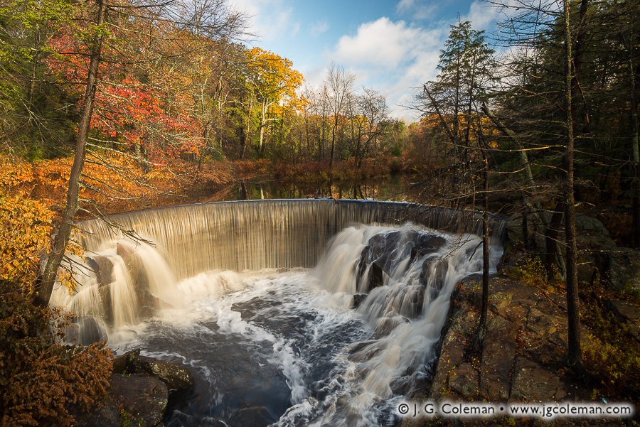
In my new piece “Pequabuck Cauldron, Autumn”, serene autumn woodlands crowd the Pequabuck River as it leaps over a relict dam which blushes with the magical glow of dawn. Perpetually in a state of discord, the cool waters are forever parting ways for delicate, orderly veils or furious, crashing whitewater.

Although Pequabuck Falls emerged as a purely natural waterfall after the withdrawal of ancient glaciers from Connecticut, a crescent-shaped dam constructed in 1851 dramatically altered their appearance. What we find here today is a “composite waterfall”, one which incorporates rocky tumbles from the original waterfall with orderly cascades over 160-year-old masonry.

Old Photograph of Pequabuck Falls
Pequabuck Falls is seen here in an old photograph dating back to sometime between 1890 and 1930. Although the old pony-truss bridge has long since been replaced, the falls themselves have actually changed very little despite the passage of a century.
© Archives & Special Collections at the Thomas J. Dodd Research Center,
University of Connecticut Libraries

Marvelously varied industries have harnessed water from Pequabuck Falls since the dam was constructed in the mid-19th century. Initially operating a clock factory, the falls later drove machinery which manufactured buckles for the uniforms of Union soldiers during the Civil War. For decades after the conflict, the site continued to turn out everything from mail bags to lumber to tool handles as enterprises came and went. It wasn’t until 1913 that the trusty waterwheel at Pequabuck Falls was finally retired.

Purchase a Fine Art Print or Inquire About Licensing

Click here to visit my landing page for “Pequabuck Cauldron, Autumn” to buy a beautiful fine art print or inquire about licensing this image.

Want to See More?

Be sure to check out all of my work from Pequabuck Falls.

Categories
All Things Connecticut New Print Releases The American Northeast

On the Outskirts of Bristol

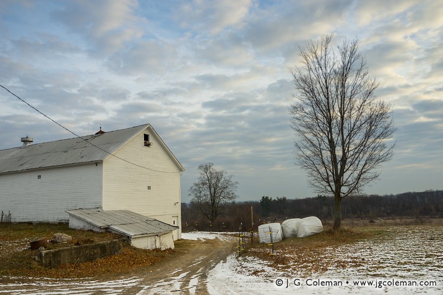
Yankee Farmlands № 49 (Farm in Bristol, Connecticut)
“Yankee Farmlands № 49”
Barn and farmland in Bristol, Connecticut
© 2016 J. G. Coleman

Clouds glow like airy jewels in the early morning as they drift over a dormant farm on the outskirts of Bristol. Down below, light snow clings to a dirt access road which winds past hay bales and a bare shade tree before vanishing behind the barn.

The last installment of Yankee Farmlands brought us to Colebrook, a rural town which was largely reclaimed by sprawling woodlands as farming declined throughout the 1800s and 1900s. Bristol represents the opposite case: as old farmland there was abandoned, it was rapidly repurposed for city expansion and residences. So while Colebrook and Bristol encompass roughly the same amount of land, the population of Bristol has swelled to be about 40 times greater!

Remarkably, a handful of farms have endured on the periphery of the city and manage to feel a world apart from the nearby suburbs and the bustling streets less than two miles to the south.

Purchase a Fine Art Print or Inquire About Licensing

Click here to visit my landing page for “Yankee Farmlands № 49” to buy a beautiful fine art print or inquire about licensing this image.

Want to See More?

Be sure to check out all of the work from my Yankee Farmlands project, a journey throughout the countryside of Connecticut in celebration of New England’s agricultural heritage.

Categories
All Things Connecticut New Print Releases The American Northeast

Remembering Pastoral Colebrook

Yankee Farmlands № 48 (Old Hale Farm, Colebrook, Connecticut)
“Yankee Farmlands № 48”
Old Hale Farm, Colebrook, Connecticut
© 2016 J. G. Coleman

When author John Barber wrote of Colebrook in the 1830s, he described the land as “hilly and mountainous”, the soil as “generally stony” and the climate as “rather cold and wet”. It would be difficult to paint a bleaker picture of this village in Connecticut’s Northwest Hills. As if he felt obligated to offer at least one redeeming quality, Barber conceded that it “affords tolerable… grazing.”

In truth, Colebrook proved to be a productive area of the state for dairy farming, even if agriculture mostly vanished from its hills over the last century. Unlike many of Connecticut’s towns, which became densely populated with suburbs after farming declined, Colebrook’s abandoned pastures and hayfields were largely covered over by expansive forests. Today, less than 1,500 people make their home among its 30 square miles of remote woodlands. This barn, built in the late 1700s, and the surrounding pastureland is preserved by a local land trust and stands as something of a memorial to generations of hard-scrabble farmers that settled Colebrook long ago.

Purchase a Fine Art Print or Inquire About Licensing

Click here to visit my landing page for “Yankee Farmlands № 48” to buy a beautiful fine art print or inquire about licensing this image.

Want to See More?

Be sure to check out all of the work from my on-going Yankee Farmlands project, a journey throughout Connecticut’s farms in celebration of New England’s agricultural heritage.