Categories
All Things Connecticut New Print Releases The American Northeast

Remembering Alice

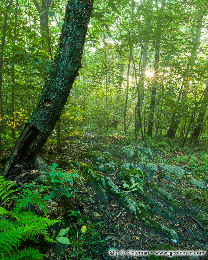
Woodland Remembrance (Alice Newton Street Memorial Park, Woodbridge, Connecticut)
“Woodland Remembrance”
Alice Newton Street Memorial Park, Woodbridge, Connecticut

In my newly-released piece, “Woodland Remembrance”, sunlight pierces the forest canopy in the heart of Woodbridge, transforming the understory into a blissfully verdant landscape fit for a fairytale.

Although Connecticut began building its state park system in the mid-1910s and town-owned parks had existed far earlier, nature preserves owned for the public good outside the realm of government were generally a slightly later phenomenon.

The Woodbridge Park Association, operating independently of Woodbridge’s town government, was among the earliest organizations in Connecticut to acquire and manage preserved land on a not-for-profit basis. The Association got its start back in 1928 when it was founded in order to fulfill the vision of philanphropist Newton Street who had decided to forever preserve over 80 acres of land in memory of his mother, Alice Street. The result, featured in this latest piece of mine, was the Alice Newton Street Memorial Park.

Purchase a Fine Art Print or Inquire About Licensing

Click here to visit my landing page for “Woodland Remembrance” to buy a beautiful fine art print or inquire about licensing this image.

Want to See More?

Be sure to check out all of my work from Alice Newton Street Memorial Park.

Categories
All Things Connecticut New Print Releases The American Northeast

Naugatuck Eternal

Naugatuck Eternal (Naugatuck River, Thomaston, Connecticut)
“Naugatuck Eternal”
Naugatuck River, Thomaston, Connecticut
© 2017 J. G. Coleman

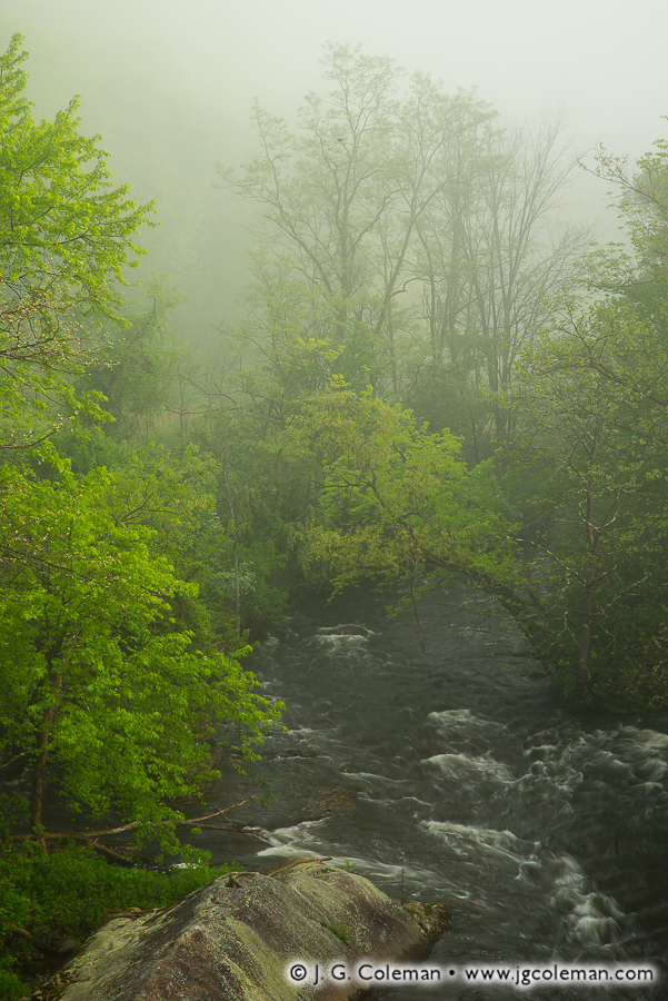
Coursing mightily after weeks of springtime rainfall, the Naugatuck River churns up wisps of whitewater as it snakes through mist-engulfed woodlands.

Over the course of a 39-mile journey from its headwaters in Northwestern Connecticut to its confluence with the Housatonic, the Naugatuck River descends more than 500 feet. Such fast-moving waters proved a boon for early industry, turning waterwheels and turbines that powered dozens of bustling factories during the 18th and 19th centuries. Of course, with that appropriation as a power source also came severe ecological decline.

Dams obstructed fish travel and decimated the fishery while factories channeled a foul stew of sewage and waste chemicals into the river on a daily basis right up until the 1960s. Mercifully, new regulations enacted in the 1970s ushered in a rejuvenating era for the Naugatuck characterized by dramatically improved water quality. Furthermore, five old dams have been removed entirely since 1999, reopening great lengths of the river to be traveled freely by rebounding fish populations.

Purchase a Fine Art Print or Inquire About Licensing

Click here to visit my landing page for “Naugatuck Eternal” to buy a beautiful fine art print or inquire about licensing this image.

Want to See More?

Be sure to check out all of my work from Connecticut.

Categories
New Print Releases The American Northeast

152 Years and Counting

Randall Crossing at Lyndon (Randall Covered Bridge over the East Branch of the Passumpsic River, Lyndon, Vermont)
“Randall Crossing at Lyndon”
Randall Covered Bridge (a.ka. Old Burrington Bridge) over the East Branch Passumpsic River, Lyndon, Vermont
© 2016 J. G. Coleman

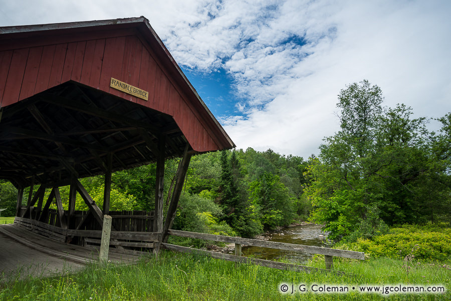
Having spent more than a century and a half amidst the countryside of northeastern Vermont, the time-worn Randall Covered Bridge feels almost as natural a part of the scenery as the surrounding woodlands or the rushing waters of the Passumpsic’s East Branch below.

Randall Covered Bridge is truly a relic from a different era, its rough-hewn timbers assembled the same year that the Civil War came to a close at Appomattox some 600 miles to the south. Records don’t identify whoever was contracted to build the bridge, but the especially wide roof and open sides follow a distinctive pattern endemic to the township and surrounding area.

When the rigors of time and the unforgiving heft of automobiles finally rendered old Randall Bridge obsolete in the 1960s, the people of Lyndon had the foresight to keep the aged timber bridge intact. So, despite having been bypassed decades ago by a modern concrete crossing just 20 feet upstream, Randall Bridge quietly enjoys its 152nd anniversary this year. And with much care and a smidgeon of luck, it’ll be there for generations to come.

Purchase a Fine Art Print or Inquire About Licensing

Click here to visit my landing page for “Randall Crossing at Lyndon” to buy a beautiful fine art print or inquire about licensing.

Want to See More?

Be sure to check out all of my work from the Randall Covered Bridge.

Categories
All Things Connecticut New Print Releases The American Northeast

New Hartford’s Shifting Center

Yankee Farmlands № 98 (Farm in New Hartford, Connecticut)
“Yankee Farmlands № 98”
Farm on cold January morning, Village of Nepaug in New Hartford, Connecticut
© 2016 J. G. Coleman

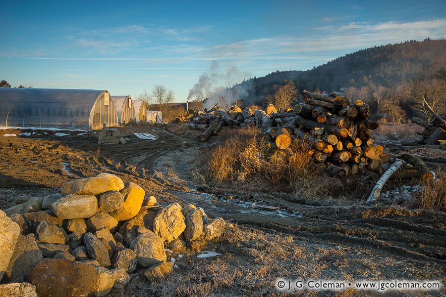
In the rural valley of Nepaug beneath the looming silhouette of Yellow Mountain, farmland is daubed with molten light upon awakening to another January morning. A dirt road creased with frozen ruts weaves amidst piled fieldstones, timbers and greenhouses before vanishing into the farm’s interior.

Although many of Connecticut’s towns have existed for centuries, their configurations have changed dramatically over time. For example, in the 1720s, New Hartford’s pioneering farmers from the Connecticut Colony settled at Town Hill just north of Yellow Mountain (which would’ve been on the far side of the hill as it’s seen in this piece) and thought of their village as the “town center” for next 100 years.

By the 1820s, though, the village of Nepaug emerged as the new town center when its productive streamside mills became the focal point of the community. But even Nepaug would eventually pass the torch when, in the 1870s, New Hartford’s very first Town Hall was built in the district of North Village. North Village had simply outgrown Nepaug during the intervening five decades and, to this very day, it still claims the unofficial designation of town center.

Purchase a Fine Art Print or Inquire About Licensing

Click here to visit my landing page for “Yankee Farmlands № 98” to buy a beautiful fine art print or inquire about licensing this image.

Want to See More?

Be sure to check out all of the work in my Yankee Farmlands project, an on-going series that explores the Connecticut countryside in celebration of the agricultural heritage of New England.

Categories
All Things Connecticut New Print Releases The American Northeast

Bouquet by the Water’s Edge

"Bouquet by the Water's Edge" (West Hartford Reservoir Trails, West Hartford, Connecticut)
“Bouquet by the Water’s Edge”
West Hartford Reservoir Trails, West Hartford, Connecticut
© 2016 J. G. Coleman

Writing in the 1890s for his book Poems of New England, J. H. Earle kicked off “A Summer Hour” with a few soothing lines:

Great the joy there is in silence
When the mind is free,
For then we here with nature talk,
And all seems in glee.

Especially when summer breezes
Waft the teeming earth,
And all landscapes seem to flourish
In nature’s glad birth.

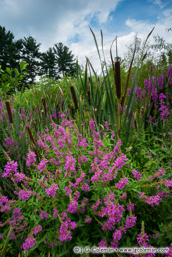
Earle probably didn’t spend much time with early cameras, but I’m fairly certain that modern landscape photography taps in to the very same vein of inspiration from which he crafted his poetry.

Purchase a Fine Art Print or Inquire About Licensing

Click here to visit my landing page for “Bouquet by the Water’s Edge” to buy a beautiful fine art print or inquire about licensing this image.

Want to See More?

Be sure to check out all of my work from the West Hartford Reservoirs.

Categories
All Things Connecticut New Print Releases The American Northeast

Making a New England Peach

Yankee Farmlands № 95 (Peach orchard during autumn, Guilford, Connecticut)
“Yankee Farmlands № 95”
Peach orchard during autumn, Guilford, Connecticut
© 2016 J. G. Coleman

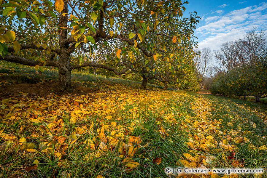
Well into November, and with the surrounding forests already stripped bare by icy winds, an orchard of wizened peach trees clings valorously to its autumn trimmings. A mosaic of fallen leaves scattered upon the grasses beneath, however, signals the inescapable reality of the coming winter.

For those who understandably associate peaches with the forgiving climate of the American South, it might seem almost bizarre to find orchards of the fruit tree dotting the New England landscape from Connecticut to Maine. Indeed, peach trees weren’t well-suited to cold weather in the beginning, often being found in the Northeast only in small plantings or backyards, more as novelties than serious fixtures in the orchard.

It wasn’t until the late 1800s that New Englanders began seeking out resilient specimens and isolating genetic flukes to produce new cold-hardy varieties that would prove commercially viable in their neck of the woods. The trees still aren’t as resilient as the venerable apple and pear –crops are occasionally decimated across the region by brutal cold snaps– but the peach has nonetheless found a permanent and welcome home in orchards of New England.

Purchase a Fine Art Print or Inquire About Licensing

Click here to visit my landing page for “Yankee Farmlands № 95” to buy a beautiful fine art print or inquire about licensing this image.

Want to See More?

Be sure to check out all of the work from my Yankee Farmlands project.

Categories
All Things Connecticut New Print Releases The American Northeast

The Clarks and The Creek

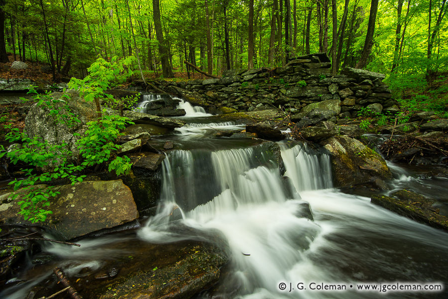
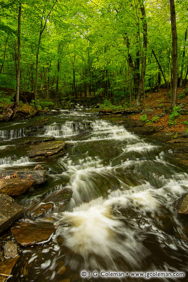
Clark Creek flits about in riffles and cascades as it snakes through old Tylerville en route to the Connecticut River. Springtime woodlands immerse the falls in shadow as soothing murmurs of tumbling water rise into the canopy.

Clark's Stairway (Clark Creek Falls on Clark Creek, Haddam, Connecticut)
“Clark’s Stairway”
Clark Creek Falls on Clark Creek, Haddam, Connecticut
© 2016 J. G. Coleman

Sometimes a simple babbling brook can, through tangential association, lead us unexpectedly into topics of great historical importance. For example, one historian recalled in 1900 that “the Clarks of… Clark’s Creek in Tylverville are descended from Major John Clark… who is named as one of the patentees in the Charter of Charles II to Connecticut in 1662.” Sure, at face value that may seem to be an obscure reference, but it’s difficult to overstate the importance of that founding document to which the name of Clark Creek can be circuitously traced.

Tylerville Cascades (Clark Creek Falls on Clark Creek, Haddam, Connecticut)
“Tylerville Cascades”
Clark Creek Falls on Clark Creek, Haddam, Connecticut
© 2016 J. G. Coleman

The Charter of 1662 gave legal blessing to the Connecticut Colony in the eyes of the English monarchy, ensuring an impressive measure of self-governance for what had previously amounted to little more than a loosely-associated series of Puritan settlements south of Massachusetts. Upon granting that early charter, it’s likely that Charles II couldn’t have imagined that Connecticut and its sibling colonies would be back just about a century later, demanding a far greater degree of self-governance that would change everything.

Purchase a Fine Art Print or Inquire About Licensing

Click here to visit my landing page for “Clark’s Stairway” or “Tylerville Cascades” to buy a beautiful fine art print or inquire about licensing either of these images.

Want to See More?

Be sure to check out all of my work from Clark Creek Falls.

Categories
All Things Connecticut New Print Releases The American Northeast

On the Origins of Memorial Day

Yankee Farmlands № 94 (Barn draped with the American flag, Stonington, Connecticut)
“Yankee Farmlands № 94”
Barn draped with the American flag, Stonington, Connecticut
© 2016 J. G. Coleman

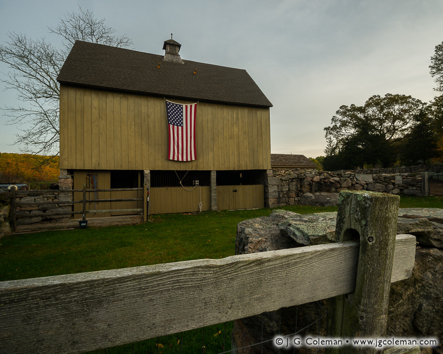
Although memorial occasions for fallen soldiers had long existed in some form, it was on the heels of Civil War that hallowed days of remembrance arose with great frequency in communities across the American countryside. Known informally as Decoration Days, these ceremonies traditionally called for adorning the graves of fallen soldiers with flowers.

When the federal government sought to formalize and unify these assorted ceremonies in 1868, the date of May 30 was chosen. As for why that day was selected, some say it was because the date lacked any association with a specific battle, while others note that late May ensured a wealth of blooming flowers for decoration.

The holiday has endured many changes since those early days. “Memorial Day” gradually supplanted “Decoration Day” as the preferred name, the date was moved from the 30th to the last Monday in May and, of greatest importance, the graves of fallen soldiers have grown ever more numerous. What hasn’t changed is the significance and the sentiment which it embodies. And so, I leave you to the upcoming Memorial Day with the words of poet Kate Sherwood, penned in her 1885 work “Camp-fire, Memorial-day and Other Poems”:

Ah, not in anger, not in strife,
we come with laden hands ;
The crimson retinues of War
are off in other lands ;
We bring the blossoms we have nursed to
shed their honeyed breath
Where erst the reeling ranks of wrath
unbarred the gates of death ;
We lift the dear dead faces
of our heroes to the light,
We praise the pallid hands of theirs,
we clasp and hold them tight ;
We say: O brothers, rise and see
the Peace you helped to woo,
Whose snowy pinions hover o’er
the Red, the White, the Blue.

Purchase a Fine Art Print or Inquire About Licensing

Click here to visit my landing page for “Yankee Farmlands № 94” to buy a beautiful fine art print or inquire about licensing this image.

Want to See More?

Be sure to check out all of the work from my Yankee Farmlands project.

Categories
All Things Connecticut New Print Releases The American Northeast

A Bit of a Delay

Yankee Farmlands № 93 (Farm in Washington, Connecticut)
“Yankee Farmlands № 93”
Washington, Connecticut
© 2016 J. G. Coleman

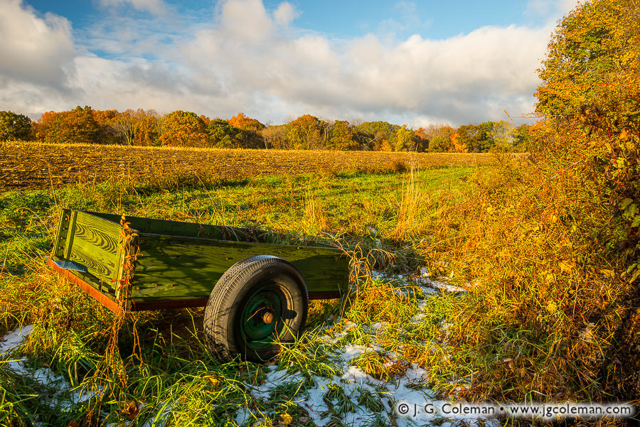
Despite being bathed in the molten glow of dawn as October comes to a close, icy temperatures more befitting of winter descend upon this mowed cornfield in the hills of Western Connecticut. Snow lingers in the shadows beside a rickety cart, remnants of a recent storm that stubbornly persist despite autumn’s protests.

I originally intended for my Yankee Farmlands project to be rolled out in real-time, each new installment having been produced only a week or two before its release. For two years or so, that’s exactly what I did. But an increase in clients and a heavy shooting schedule last autumn made it prohibitive to continue such a rigorous roll-out.

The result? You’re just now seeing the project installments that I was shooting about seven months ago. But I must say, there’s something strangely satisfying (in a contrary sort of way) about rolling out imagery of a chilly autumn day just as Connecticut abruptly ticks up into the 90s.

Purchase a Fine Art Print or Inquire About Licensing

Click here to visit my landing page for “Yankee Farmlands № 93” to buy a beautiful fine art print or inquire about licensing this image.

Want to See More?

Be sure to check out all of the work from my Yankee Farmlands project.

Categories
New Print Releases The American Northeast

Salvelinus Sanctuary

Salvelinus Sanctuary (Pherrins River, Morgan, Vermont)
“Salvelinus Sanctuary”
Pherrins River, Morgan, Vermont
© 2017 J. G. Coleman

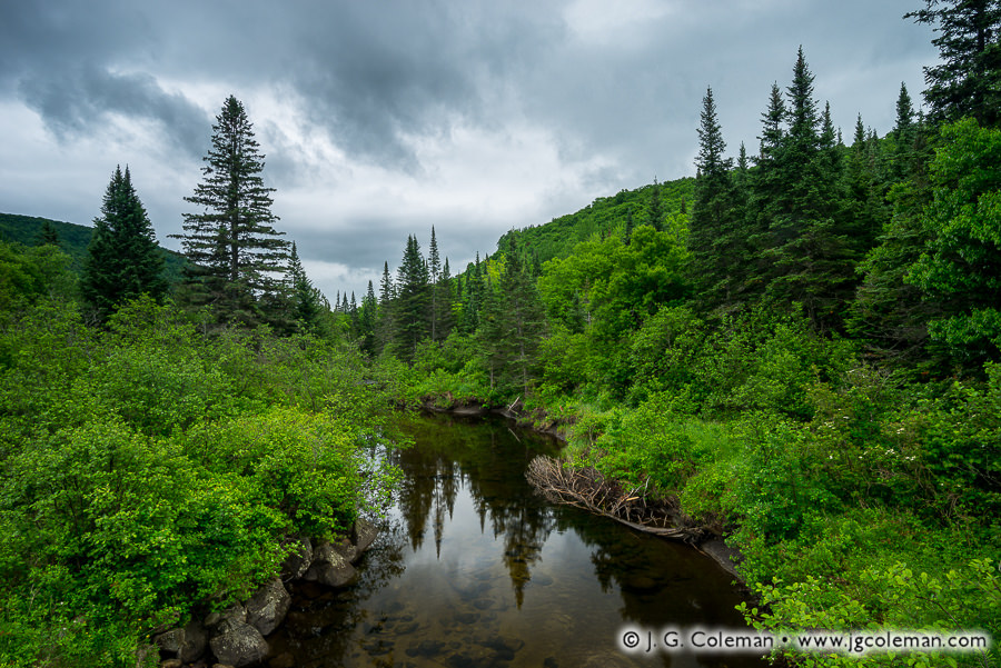
As a rainstorm brews in the clouds above, the Pherrins River lazily snakes through the wilds of Northeastern Vermont, concealing a thriving population of the much sought-after native brook trout.

I produced this piece during a June fishing trip in Vermont’s Northeast Kingdom last year, not long after my friends and I pulled several beautiful “brookies” from pools and riffles along this river. With June approaching once again, I’m growing excited to see where this year’s Vermont odyssey brings me.

Purchase a Fine Art Print or Inquire About Licensing

Click here to visit my landing page for “McCook’s Refuge” to buy a beautiful fine art print or inquire about licensing this image.

Want to See More?

Be sure to check out all of my work from East Lyme, Connecticut.

Categories
All Things Connecticut New Print Releases The American Northeast

Atop the Barndoor Hills

Yankee Farmlands № 92 (Barndoor Hills, Granby, Connecticut)
“Yankee Farmlands № 92”
Granby, Connecticut
© 2016 J. G. Coleman

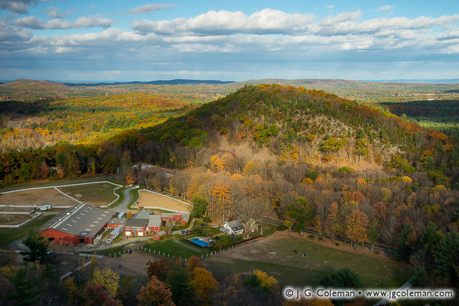
Nestled in a cozy valley between the monolithic Barndoor Hills, the stables and white-fenced pastureland of a picturesque horse ranch contrast with the expansive forests of Connecticut’s northwest.

Prior to the advent of automobiles in the 20th century, horses were a ubiquitous mode of transportation throughout the United States. And, perhaps thanks to Wild West films, it’s not hard for us these days to envision an era when horses were commonplace. But when did these animals arrive in New England?

Native Americans living in New England did not possess horses prior to European contact. And although the Pilgrims were exceptionally familiar with horses in their homeland, they neglected to bring any along on their pioneering voyage to establish Plymouth on the Massachusetts coast in 1620. Explicit mention of a horse in Southern New England doesn’t appear in records until 1632, when the governor of the Massachusetts Bay Colony mentions riding the “Governor’s mare” while traveling between villages.

Purchase a Fine Art Print or Inquire About Licensing

Click here to visit my landing page for “Yankee Farmlands № 92” to buy a beautiful fine art print or inquire about licensing this image.

Want to See More?

Be sure to check out all of the work from my Yankee Farmlands project.

Categories
All Things Connecticut New Print Releases The American Northeast

McCook’s Refuge

McCook's Refuge (McCook Point Park, East Lyme, Connecticut)
“McCook’s Refuge”
McCook Point Park, East Lyme, Connecticut
© 2017 J. G. Coleman

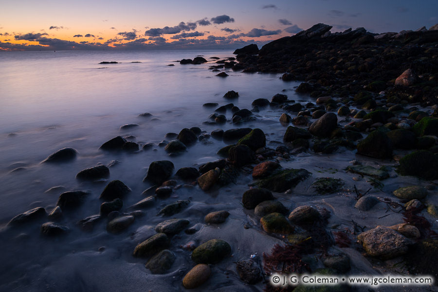
Early May doesn’t generally present the most welcoming beach weather in Southern New England, but it’s far preferable to the biting, 15° F winds that I encountered at McCook Point before dawn during the first days of March this past winter.

Found along the Connecticut coast on the sandy shores of Niantic, McCook’s Point had been known instead as Champlain’s Point prior to the mid-1800s. It wasn’t until a theology professor out of East Hartford, Reverend John James McCook, began spending summers there in 1869 that the proverbial seed was planted for a change of names.

What probably cemented McCook’s name on the point was a legal battle with state government in the 1920s. A small, state-operated tuberculosis hospital had been established nearby and it quickly became clear that a larger facility was required. McCook and his family refused to sell their 16-acre property to accommodate the hospital expansion and even fought the state in court when an attempt was made to condemn the property. The McCook family prevailed and the state abandoned its efforts in 1930, just three years after old John McCook passed away.

Purchase a Fine Art Print or Inquire About Licensing

Click here to visit my landing page for “McCook’s Refuge” to buy a beautiful fine art print or inquire about licensing this image.

Want to See More?

Be sure to check out all of my work from East Lyme, Connecticut.