Categories
All Things Connecticut New Print Releases The American Northeast

Schaghticoke Rising

Schaghticoke Rising (Housatonic River, Kent, Connecticut)
“Schaghticoke Rising”
Housatonic RiverKent, Connecticut
© 2015 J. G. Coleman

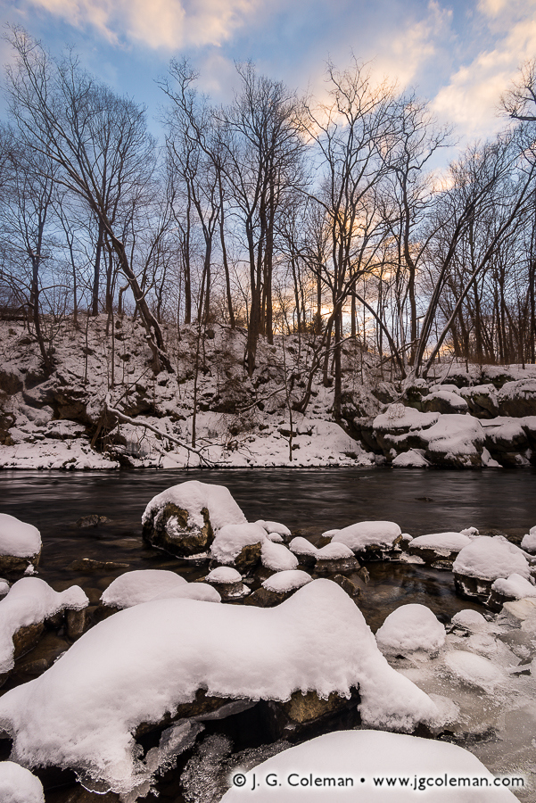
With the recent weather here in Southern New England mercifully cooling, it seems timely to remind everyone to enjoy what’s left of the summer. If there’s a lingering shred of superstition in your bones, you’ll take heed that the Farmer’s Alamanac calls for “copious amounts of snow” during the coming winter with the “coldest outbreak of the season” predicted for late January.

I produced the piece seen here along the wintry banks of the Housatonic during the final week of January earlier this year. The riverscape that morning lent a certain presence to nature’s penchant for paradox; awakening with splendor, yet still so very dormant… at once, both enchanting and foreboding. “Schaghticoke Rising” (above) was my effort at capturing that bewildering contradiction as it unfolded in the minutes before dawn.

For the curious minds out there, the title of this piece hearkens back to the earliest days of Kent when the remnants of declining native tribes across Connecticut took refuge from encroaching Europeans in the rough, wooded hills of the township. Calling themselves the Schaghticoke (usually pronounced Scat-uh-cook), this amalgam of native peoples became one of the largest indigenous nations in Southern New England. They were also granted one of the earliest reservations ever created in the New World, obtaining some 2,500 acres from the Connecticut Colony in 1736.

Purchase a Fine Art Print or Inquire About Licensing

Click here to visit my landing page for “Schaghticoke Rising” to buy a beautiful fine art print or inquire about licensing this image.

Want to See More?

Be sure to check out all of my work from Bull’s Bridge and the Housatonic River at Kent.

Categories
All Things Connecticut New Print Releases The American Northeast

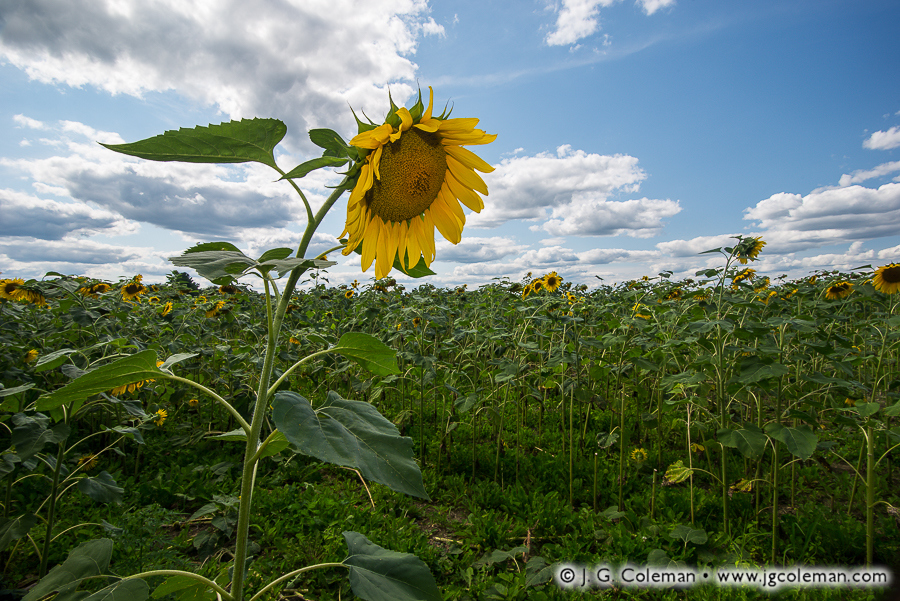
Giant Sunflowers of Griswold

Yankee Farmlands № 34 (Field of giant sunflowers in Connecticut’s “Quiet Corner”, Griswold, Connecticut)
“Yankee Farmlands № 34”
Field of giant sunflowers in Connecticut’s “Quiet Corner”, Griswold, Connecticut
© 2015 J. G. Coleman

Giant sunflowers crowd a verdant field in Connecticut’s Eastern Uplands as sprawling clouds drift across the summertime sky. The vista featured in “Yankee Farmlands No. 34” (above) is the latest installment in my project which celebrates the agricultural heritage of Southern New England through Connecticut’s scenic farmlands.

Among North America’s ancient food crops, the sunflower was widely cultivated by Native Americans for at least 4,000 years before Spanish explorers first laid eyes on the plant in the 1500s. Specimens were brought back home to Spain and, from there, spread throughout Europe.

Russia can be credited with breeding the gargantuan sunflowers with which we are familiar today. But while sunflowers had grown popular in Europe, they had fallen out of vogue as crops in North America. So even though sunflowers began their journey as food crops thousands of years ago in the Americas, the modern practice of farming them in the United States didn’t really take off until Russia shipped their huge sunflowers overseas in the late 1800s.

Purchase a Fine Art Print or Inquire About Licensing

Click here to visit my landing page for “Yankee Farmlands № 34” to buy a beautiful fine art print or inquire about licensing this image.

Want to See More?

Be sure to check out all of my work from the on-going Yankee Farmlands collection.

Categories
All Things Connecticut New Print Releases The American Northeast

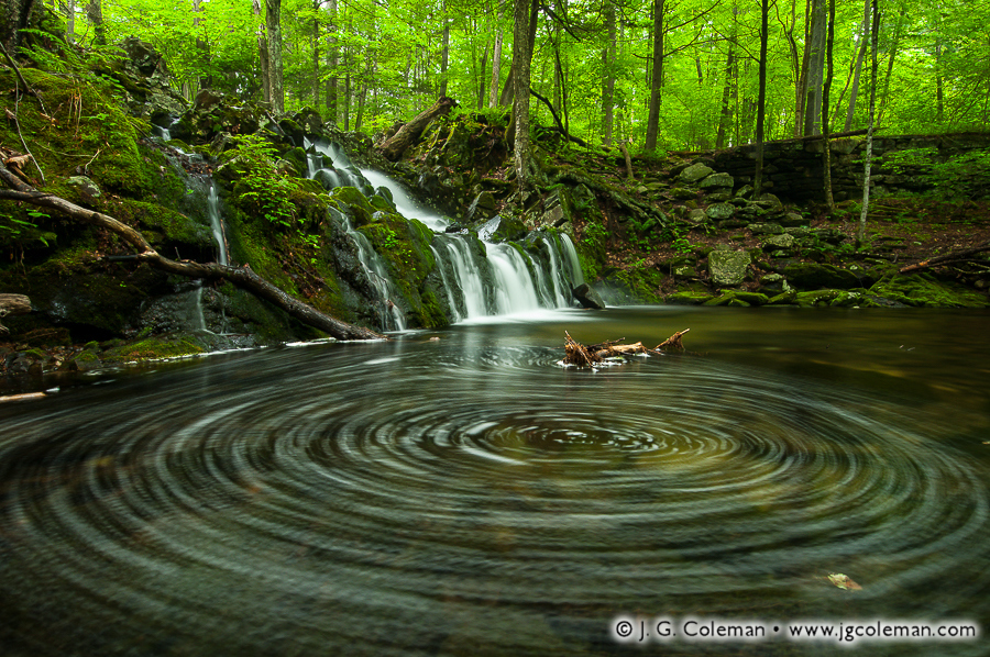
Rings of Northgate

Rings of Northgate (Northgate Falls, Simsbury, Connecticut)
“Rings of Northgate”
Northgate Fall, Simsbury, Connecticut
© 2015 J. G. Coleman

In my latest piece, “Rings of Northgate”, foam churns away at the foot of Northgate Falls, swirling ceaselessly amidst a shallow, mossy gorge beneath woodlands in the northwest of Simsbury.

Even fairly small waterfalls such as this one, found along a nameless branch of Bissell Brook, were a boon to settlers as they migrated throughout the wilds of Connecticut in the early days. The hollow that was formed when a brook descended abruptly into gorge meant that a relatively small dam could impound plenty of water to operate a stream-side mill.

After discovering old fieldstone retaining walls lining the gorge at Northgate Falls, my curiosity was piqued. I used computer software to carefully overlay a hand-drawn map of Simsbury from 1868 upon modern satellite imagery. Sure enough, the 19th-century map shows a dammed pond labelled “Saw Mill” at the exact location of Northgate Falls; it’s likely that the mill site was already quite old even at that time.

Purchase a Fine Art Print or Inquire About Licensing

Click here to visit my landing page for “Rings of Northgate” to buy a beautiful fine art print or inquire about licensing this image.

Want to See More?

Be sure to check out all of my work from Northgate Falls.

Categories
All Things Connecticut New Print Releases The American Northeast

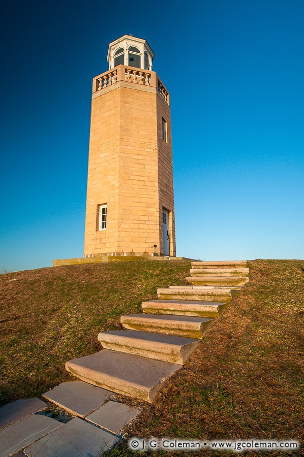
Our Last Light

Our Last Light (Avery Point Lighthouse, Avery Point, Groton, Connecticut)
“Our Last Light”
Avery Point Lighthouse at Avery Point, Groton, Connecticut
© 2015 J. G. Coleman

Perched on a seaside bluff where the Thames River empties into Long Island Sound, Avery Point Lighthouse is painted by warm, sunrise light against the deep blues of a cloudless canvas.

For much of New England’s history, lighthouses were always in short supply. They were expensive to build and required ceaseless maintenance. Yet, with each beacon that was finally completed, it seemed that seafarers could think of two more places where new lighthouses were still desperately required to guide vessels through treacherous waters.

For Connecticut, though, that all began to change in the 1900s. There was only a need for so many lighthouses along the shoreline, and for the first time in the state’s long history, it was safe to say that they had all been constructed. The Avery Point Lighthouse, erected during World War II in 1943, would prove to be the last beacon built along Connecticut’s 100-mile coastline.

Purchase a Fine Art Print or Inquire About Licensing

Click here to visit my landing page for “Our Last Light” to buy a beautiful fine art print or inquire about licensing this image.

Want to See More?

Be sure to check out all of my work from Avery Point and the Avery Point Lighthouse.

Categories
All Things Connecticut New Print Releases The American Northeast

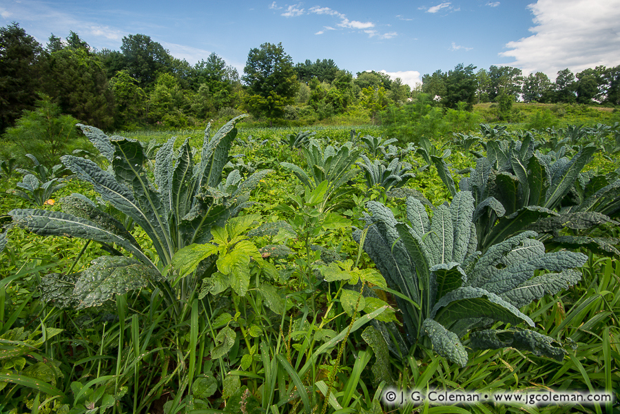
Fields of Kale at West Granby

Yankee Farmlands № 32 (Farm field with kale, Granby, Connecticut)
“Yankee Farmlands № 32”
Field of kale, Granby, Connecticut
© 2015 J. G. Coleman

In the latest addition to my Yankee Farmlands project, wrinkled plumes of kale climb over encroaching weeds on a swath of sunny cropland in the hills of West Granby. Warm, summertime air drifts lazily through the field, the breeze too faint to stir the still forests along the farm edge.

Vegetables such as kale, collards, cabbage, broccoli, cauliflower, kohlrabi and brussel sprouts are popular greens that occasionally even share the same field. But would you believe that every one of those vegetables represents the same species? That’s right… even though they may look dramatically different, they all possess genes which are virtually identical to those of a weed known as “wild lettuce”.

How was such a diverse array of vegetables derived from a single species? Thousands of years ago, early farmers carefully selected generation after generation of cultivated wild lettuce to promote certain desired traits: long stems for kohlrabi, enlarged flower buds for broccoli, broad leaves for kale and so on.

Purchase a Fine Art Print or Inquire About Licensing

Click here to visit my landing page for “Yankee Farmlands № 32” to buy a beautiful fine art print or inquire about licensing this image.

Want to See More?

Be sure to check out all of my work in my ever-growing Yankee Farmlands project, a series which celebrates the agricultural heritage of Southern New England through the beautiful farmlands of Connecticut.

Categories
All Things Connecticut New Print Releases The American Northeast

Keeper Woods’ Lament

Keeper Woods' Lament (Old Saybrook Breakwater Lighthouse, Old Saybrook, Connecticut)
“Keeper Woods’ Lament”
Old Saybrook Breakwater Light off Lynde Point in Long Island Sound, Old Saybrook, Connecticut
© 2015 J. G. Coleman

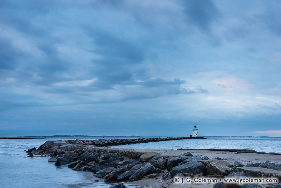
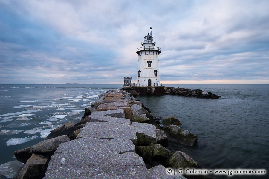
Remember how cold it was last winter? Or did you already block that memory out? Well, my latest releases were produced during the waning weeks of winter this year along the wind-swept coastline of Old Saybrook and feature the Saybrook Breakwater Lighthouse perched on the far end of a serpentine, granite jetty beneath a twilight sky streaked with foreboding clouds.

Known sometimes as the Saybrook Outer Light to distinguish it from the Lynde Point Lighthouse on the mainland nearby, the Saybrook Breakwater Light was built in 1886 roughly 1/3-mile offshore at the terminus of a long, granite breakwater. The massive stone jetty had been created to prevent the formation of dangerous, shallow sand bars at the mouth of the Connecticut River which had plagued shipping traffic for years.

Twilight Upon the Granite Path (Old Saybrook Breakwater Lighthouse, Old Saybrook, Connecticut)
“Twilight Upon the Granite Path”
Old Saybrook Breakwater Light off Lynde Point in Long Island Sound, Old Saybrook, Connecticut
© 2015 J. G. Coleman

I titled one of my new works (at top), “Keeper Woods’ Lament”, based upon the story of Joseph Woods, who was tending the lighthouse in 1917 when he submitted a grievance to officials regarding the rigors of his job. “I am on duty twenty-four hours out of twenty-four hours and the only relief I get is when my wife begs of me to rest while she stands watch.” All he asked was that an assistant be posted at the lighthouse so that he might have time to relax on occasion. His request was denied.

Purchase a Fine Art Print or Inquire About Licensing

Click here to visit my landing page for “Keeper Woods’ Lament” or “Twilight Upon the Granite Path” to buy a beautiful fine art print or inquire about licensing these images.

Want to See More?

Be sure to check out all of my work from the Old Saybrook Breakwater Lighthouse.

Categories
All Things Connecticut New Print Releases The American Northeast

Okumsett Fringe

Okumsett Fringe (Glen Falls near Okumsett Preserve, Portland, Connecticut)
“Okumsett Fringe”
Glen Falls near Okumsett Preserve, Portland, Connecticut
© 2015 J. G. Coleman

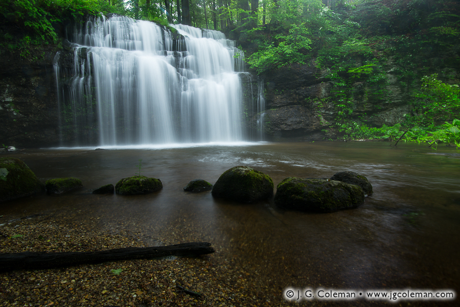
In my new release, “Okumsett Preserve”, Glen Falls glows with whitewater as it careens over a sheer, 20-foot ledge, plunging Cobalt Stream into a shallow, woodland oasis lined by mossy cliffs, gravel beds and swaying ferns.

As early as the mid-1600s, the lands surrounding the mile-long Cobalt Stream were firmly believed to be rich in various ores and precious metals. Connecticut’s first governor, John Winthrop, laid claim to some 800 acres in the area and legends tell of him camping out in the hills, assiduously mining gold and casting rings that he would carry back to his home in New London. The territory consequently received the nickname, “The Governor’s Ring”.

Generation after generation of enterprising men made countless attempts to mine the Governor’s Ring for about 200 years. Some sought gold and silver, while others set their sights toward cobalt and lead. Except for occasional veins of cobalt, most of these operations proved fruitless. By 1844, a Connecticut geology professor finally summed up two centuries of unproductive mining around Cobalt Stream: “it is a curious fact, that after all that has been done in this mine, very little is really known to the public as to the worth of the minerals located there, and whether it could be worked to any profit.”

Purchase a Fine Art Print or Inquire About Licensing

Click here to visit my landing page for “Okumsett Fringe” to buy a beautiful fine art print or inquire about licensing this image.

Want to See More?

Be sure to check out all of my work from Glen Falls and Okumsett Preserve.

Categories
All Things Connecticut New Print Releases The American Northeast

Fieldstone Walls of New England

Yankee Farmlands № 31 (Fieldstone wall in Bolton, Connecticut, USA)
“Yankee Farmlands № 31”
Bolton, Connecticut
© 2015 J. G. Coleman

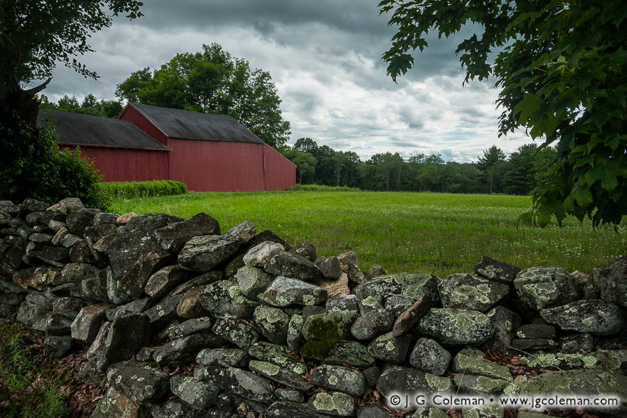
“Yankee Farmlands № 31” is the latest installment in an on-going project of mine in which I celebrate the agricultural heritage of New England through the scenic farmlands of Connecticut. This time around, we find ourselves in the small town of Bolton, peering at a barn and forest-bound meadow over the lichen-encrusted rocks of an iconic fieldstone wall.

Most of New England’s fieldstone walls were built 150 to 200 years ago during an era in which an ever-growing population was feverishly clearing new farmland. Exhausting labor went into constructing these walls as untold tons of stone were plucked from the upper layers of soil, hauled off to the outskirts of the pasture or field and loosely stacked by hand.

These relict stone walls are celebrated for their rustic aesthetic these days, but we might be surprised to discover that they were considered rather mundane at the time of their construction. For the Yankee farmers that built them, fieldstone walls merely represented a practical way to dispose of agricultural refuse. It wasn’t until the 20th-century, when much of New England’s age-old agrarian ways had faded, that rustic stone walls became romantic relics of a simpler, unhurried era in the region’s history.

Purchase a Fine Art Print or Inquire About Licensing

Click here to visit my landing page for “Yankee Farmlands № 31” to buy a beautiful fine art print or inquire about licensing this image.

Want to See More?

Be sure to check out all of the landscape photography from my on-going Yankee Farmlands project.

Categories
All Things Connecticut New Print Releases The American Northeast

The Old Days at Cotton Hollow

Cotton Hollow Echoes (Roaring Brook at Cotton Hollow Preserve, Glastonbury, Connecticut)
“Cotton Hollow Echoes”
Roaring Brook at Cotton Hollow Preserve, Glastonbury, Connecticut
© 2015 J. G. Coleman

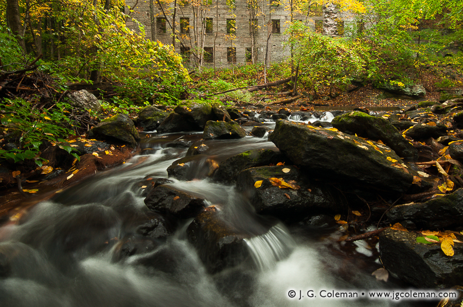
“Cotton Hollow Echoes”, one of my new pieces released this week, brings us to the shady depths of Glastonbury’s Cotton Hollow, where spirited cascades along Roaring Brook serenade the haunting, overgrown edifice of a long-abandoned mill.

There was a time when this stretch of Roaring Brook was the epicenter of South Glastonbury’s industrial might. From the 1700s onward, the river was lined with mills and factories that dammed the river, harnessing its strength to animate machinery. Cotton Hollow saw the production of everything from gun powder to boat anchors to its eponymous cotton textiles.

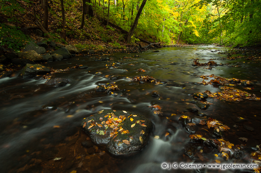
The Brook Remembers (Roaring Brook at Cotton Hollow Preserve, Glastonbury, Connecticut)
“The Brook Remembers”
Roaring Brook at Cotton Hollow Preserve, Glastonbury, Connecticut
© 2015 J. G. Coleman

But times change; so does technology. Once modern electrical grids eliminated the need for industry to be tethered to rivers, the crowded mills along Roaring Brook were slowly silenced. Boulder dams were eventually toppled. Woodlands eagerly reclaimed the river. Today, a quiet nature preserve occupies the very riverbanks where throngs of mill workers once labored amidst a cacophony of frantic machinery.

Purchase a Fine Art Print or Inquire About Licensing

Click here to visit my landing page for “Cotton Hollow Echoes” or “The Brook Remembers” to buy a beautiful fine art print or inquire about licensing this image.

Want to See More?

Be sure to check out all of my work from Roaring Brook and the forests of Cotton Hollow.

Categories
All Things Connecticut New Print Releases The American Northeast

Hammonasset Descending

Hammonasset Descending (Hammonasset River, Madison, Connecticut)
“Hammonasset Descending”
Hammonasset River, Madison, Connecticut
© 2015 J. G. Coleman

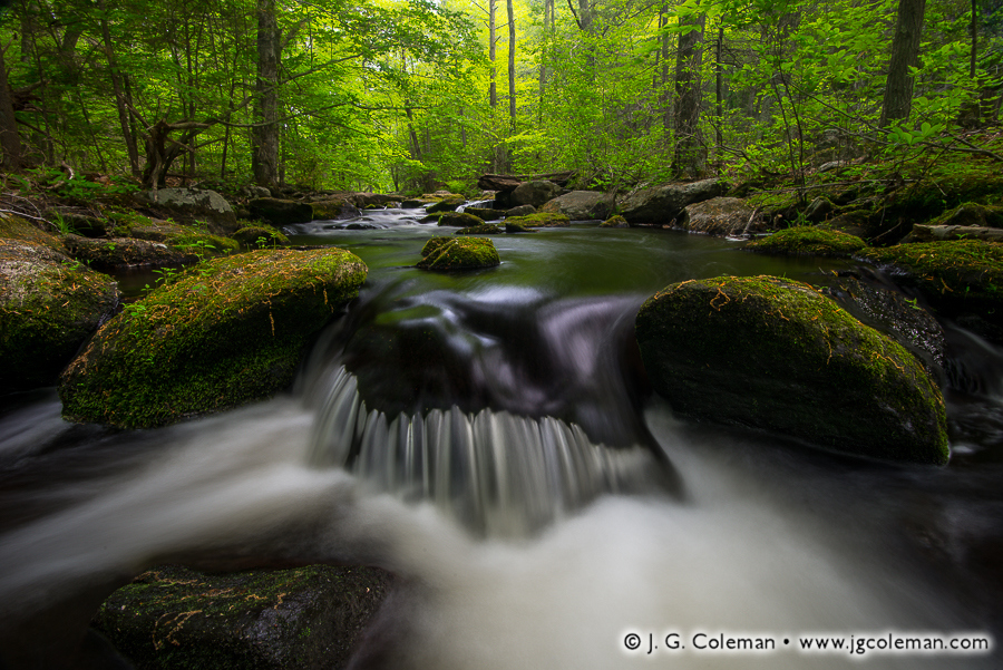
My latest work features the lively cascades and verdant woodland banks of the Hammonasset River, which forms the border between Madison and Killingworth as it courses south from Lake Hammonasset en route to Long Island Sound.

Along its northern stretches, the Hammonasset River is a modest, boulder-strewn brook with cool waters shaded by a dense forest canopy. Swirling pools, rips and riffles along its course are home to Connecticut’s only native trout: the brook trout. These fish are an important “indicator species” because their presence in a stream suggests that the water is sufficiently clean and cool; in short, that the habitat is in good shape. When the brook trout vanish, you can bet that major disturbances to the river ecosystem are to blame.

Oh, and just in case there was any doubt that brook trout still thrive in the Hammonasset, I was more than obliged to pull a fish from the very pool seen here in “Hammonasset Descending” this spring; an exquisite specimen, washed over with some incredible colors and patterning.

Purchase a Fine Art Print or Inquire About Licensing

Click here to visit my landing page for “Hammonasset Descending” to buy a beautiful fine art print or inquire about licensing this image.

Want to See More?

Be sure to check out all of my work from the northern stretches of the Hammonasset River.

Categories
All Things Connecticut The American Northeast

On the Cover of the Litchfield Town Guide

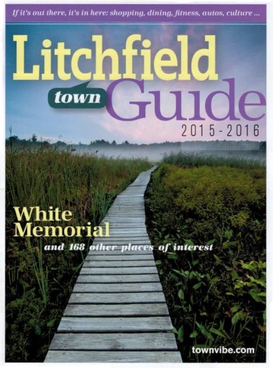
Litchfield Town Guide 2015-2016, cover featuring photography by J. G. Coleman
Litchfield Town Guide Cover, 2015-2016

It’s particularly gratifying whenever I see my photography put to use in a publication, even more so when its placement is prominent. This year’s Litchfield Town Guide does just that, filling its cover with one of my pieces from the wildlands of Litchfield, Connecticut.

When I produced my piece, “Ethereal Passage”, in mid-August of 2012 on the boardwalks around Little Pond at the White Memorial Foundation, its cover-worthiness was the last thing on my mind. My only interest in that moment before dawn, as I stood beneath a sky painted with wisps of faintly luminous clouds, was to capture the weather-beaten boardwalk as it meandered its way through shadowy wetlands towards a whimsical vanishing point in the misty, silhouetted forest on the horizon. The shot came together exactly as I had envisioned.

And, as it would happen, “Ethereal Passage” was precisely what Litchfield Magazine had in mind when it began looking for a cover photograph for its 2015 town guide. As a directory of places-to-go and things-to-do in the lovely town of Litchfield, it’s only fitting that the sprawling, 4,000-acre nature preserve in town operated by the White Memorial Foundation would be the first thing readers see!

Purchase a Fine Art Print or Inquire About Licensing

Click here to visit my landing page for “Ethereal Passage” to buy a beautiful fine art print or inquire about licensing this image.

Want to See More?

Be sure to check out all of my work from the White Memorial Foundation in Litchfield, Connecticut.

Categories
All Things Connecticut New Print Releases The American Northeast

Salmon River Wildlands

Salmon River Wildlands (Salmon River at Salmon River State Forest, Colchester, Connecticut)
“Salmon River Wildlands”
Salmon River at Salmon River State Forest, Colchester, Connecticut
© 2015 J. G. Coleman

My piece, “Salmon River Wildlands”, brings you to the wooded banks of the Salmon River as it meanders through Colchester, Connecticut en route to its confluence with the Connecticut River. Riffles and wisps of whitewater wrinkle the river’s surface, which gleams with reflections of early morning light.

There was a time —back in the earliest colonial era of New England— when the Salmon River’s namesake, Atlantic Salmon, could be seen heading upstream in droves to spawn each year during autumn. It would’ve been a spectacle every bit as impressive as the modern salmon runs of Alaska and Western Canada. But dam-building, among other pressures, delivered a death blow to the species, barricading hundreds of miles of streams and brooks and cutting salmon off from their ancient breeding grounds. Annual migrations that had occurred faithfully for thousands of years in Connecticut came to a grinding halt after barely more than a century of European settlement. The Connecticut River strain of Atlantic Salmon was extinct before 1800, preserved only in the name of a few rivers and brooks where they had once flourished.

Purchase a Fine Art Print or Inquire About Licensing

Click here to visit my landing page for “Salmon River Wildlands” to buy a beautiful fine art print or inquire about licensing this image.

Want to See More?

Be sure to check out all of my work from Connecticut’s Salmon River State Forest.