Categories
All Things Connecticut New Print Releases The American Northeast

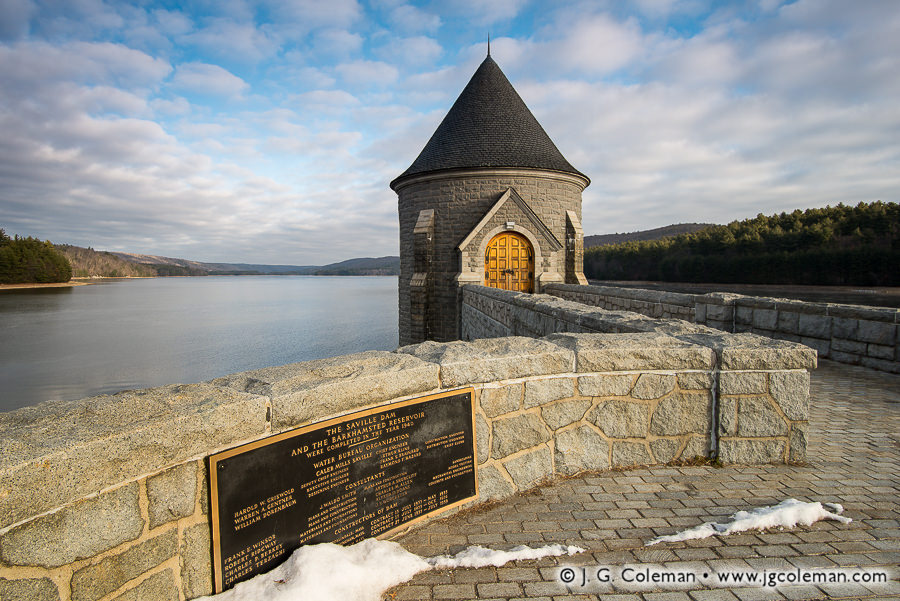
To the Memory of Saville

To the Memory of Saville (Saville Dam & Barkhamsted Reservoir, Barkhamsted, Connecticut)
“To the Memory of Saville”
Saville Dam & Barkhamsted Reservoir, Barkhamsted, Connecticut
© 2016 J. G. Coleman

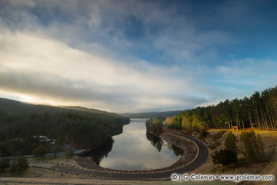
The Saville Dam represents one of the more ambitious civil engineering projects in Connecticut’s history; certainly one of the largest efforts aimed at securing drinking water. Spanning the east branch of the Farmington River in the northwestern hills, it impounds the watercourse for more than 8 miles in the Barkhamsted Reservoir and holds over 35 billion gallons of water.
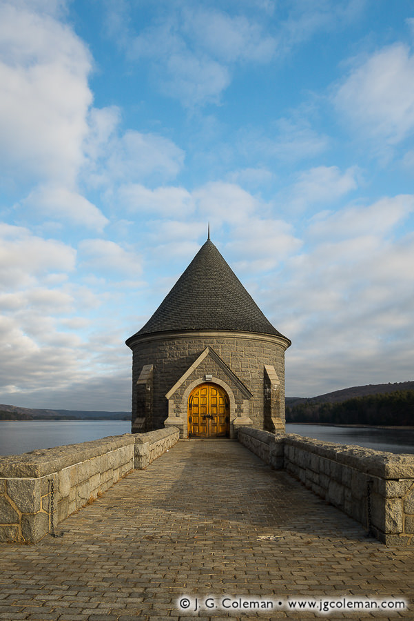
Saville's Tower (Saville Dam & Barkhamsted Reservoir, Barkhamsted, Connecticut)
“Saville’s Tower”
Saville Dam & Barkhamsted Reservoir, Barkhamsted, Connecticut
© 2016 J. G. Coleman

At the planning stage in the 1920s, it was determined the village of Barkhamsted Hollow sat squarely in the footprint of the future reservoir and the earliest buy-outs began in 1927. Despite fervent outcry from the community, almost a decade of pressure left the township empty. Building of the dam itself commenced in 1936 under the direction of brilliant chief engineer, Caleb Saville. Saville Dam was completed in 1940 but, remarkably, it would take another 8 years before the Farmington could completely fill such a massive reservoir.
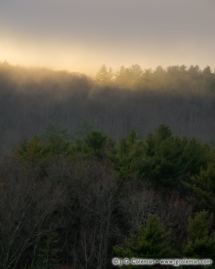
Kindling the Hills (Hills beside Barkhamsted Reservoir, Barkhamsted, Connecticut)
“Kindling the Hills”
Hills beside Barkhamsted Reservoir, Barkhamsted, Connecticut
© 2016 J. G. Coleman

As for the long-lost village of Barkhamsted Hollow, it’s been entirely wiped from the map. Community cemeteries, which were moved from the hamlet before dam-building began, can be found orphaned in the hills nearby. Old dirt roads that once led into the village abruptly terminate at the water’s edge. And although accounts suggest that most of the community was torn down prior to flooding, divers are said to have discovered everything from Ford Model Ts to old covered bridges on the bottom of the reservoir.

Purchase a Fine Art Print or Inquire About Licensing

Click here to visit my landing page for “To the Memory of Saville” to buy a beautiful fine art print or inquire about licensing this image.

Want to See More?

Be sure to check out all of my work from the Saville Dam, Barkhamsted Reservoir and nearby Lake McDonough.

Categories
All Things Connecticut New Print Releases The American Northeast

Arise McDonough

Arise McDonough (Lake McDonough, Barkhamsted, Connecticut)
“Arise McDonough”
Lake McDonough, Barkhamsted, Connecticut
© 2016 J. G. Coleman

Nestled amidst a sprawling evergreen forest, the mirror-smooth waters of Lake McDonough lay in shadow even as the first searing beams of morning light break over nearby hilltops and cast a fiery glow upon the woodlands at the water’s edge.

"McDonough Daydream (Lake McDonough, Barkhamsted, Connecticut)
“McDonough Daydream”
Lake McDonough, Barkhamsted, Connecticut
© 2016 J. G. Coleman

“Whiskey is for drinking; water is for fighting over.” So said the celebrated Mark Twain, whose words echo the bitterness which surrounded Connecticut’s hundred-year quest to build enough reservoirs to satisfy the water needs of its crowded capital region. Lake McDonough, at 400 acres, is among the more modest components of that system. Between the 1850s and 1960s, several dams were constructed in the hills west of the metropolitan area, completing a network of reservoirs that collects water from 90 square miles and provides for hundreds of thousands of people in Central Connecticut.

Interestingly, the dark side of this otherwise admirable accomplishment is nowhere in sight. That’s because rural towns and valley farms that found themselves in the path of these impoundments were buried without a trace in watery graves, sacrificed without ceremony in the struggle to secure mankind’s oldest necessity.

Purchase a Fine Art Print or Inquire About Licensing

Click here to visit my landing page for “Arise McDonough” to buy a beautiful fine art print or inquire about licensing this image.

Want to See More?

Be sure to check out all of my work from Lake McDonough, Saville Dam & Barkhamsted Reservoir.

Categories
All Things Connecticut New Print Releases The American Northeast

Simsbury Blossoming

Yankee Farmlands № 83 (Field of decorative flowers, Simsbury, Connecticut)
“Yankee Farmlands № 83”
Field of decorative flowers, Simsbury, Connecticut
© 2016 J. G. Coleman

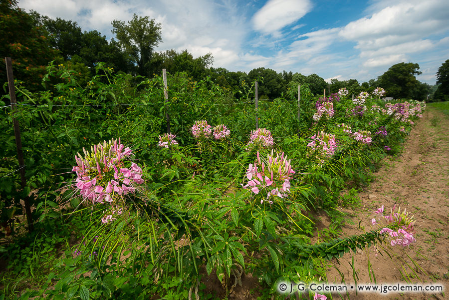
Exotic blossoms invite vivid color into a dusty farm field in Northern Connecticut where decorative flowers have reached maturity. Blue skies and a leaf-dense woodline embody the warmth and vitality of late summer in New England.

I’ve recently finished shooting for my Yankee Farmlands project, an endeavor which I thought would require roughly a year of work. Well, here we are now… nearly two and half years after I shot Yankee Farmlands № 1 at a hayfield in East Granby. It’s been a far longer, and far more rewarding, journey than I could’ve anticipated.

Over the coming weeks, I’ll be rolling out all of the final installments of the project, picking things back up where I left off in late summer, transitioning through this past autumn and concluding with pieces I produced recently this winter. I sincerely hope that you enjoy the visual story I’ve sought to tell about Connecticut’s agricultural landscapes; it’s certainly been a pleasure to create the final chapters.

Purchase a Fine Art Print or Inquire About Licensing

Click here to visit my landing page for “Yankee Farmlands № 83” to buy a beautiful fine art print or inquire about licensing this image.

Want to See More?

Be sure to check out all of the work in my on-going Yankee Farmlands project.

Categories
New Print Releases The American Northeast Vermont

Creamery Crossing at Brattleboro

Creamery Crossing at Brattleboro (Creamery Covered Bridge over Whetstone Brook, Brattleboro, Vermont)
“Creamery Crossing at Brattleboro”
Creamery Covereed Bridge over Whetstone Brook, Brattleboro, Vermont
© 2016 J. G. Coleman

With at least a foot of snow descending upon most of New England right now, how about a throwback to the inviting warmth of this past spring?

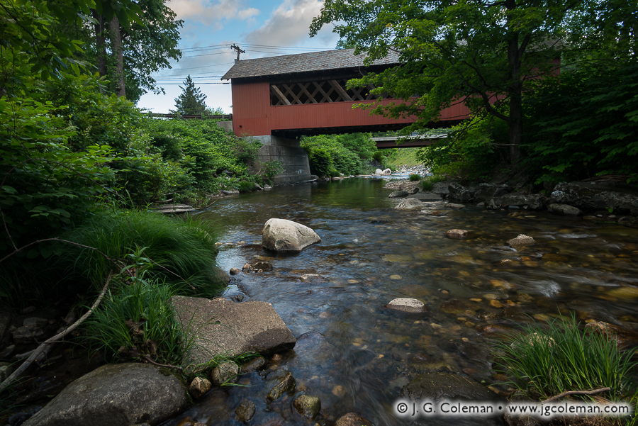
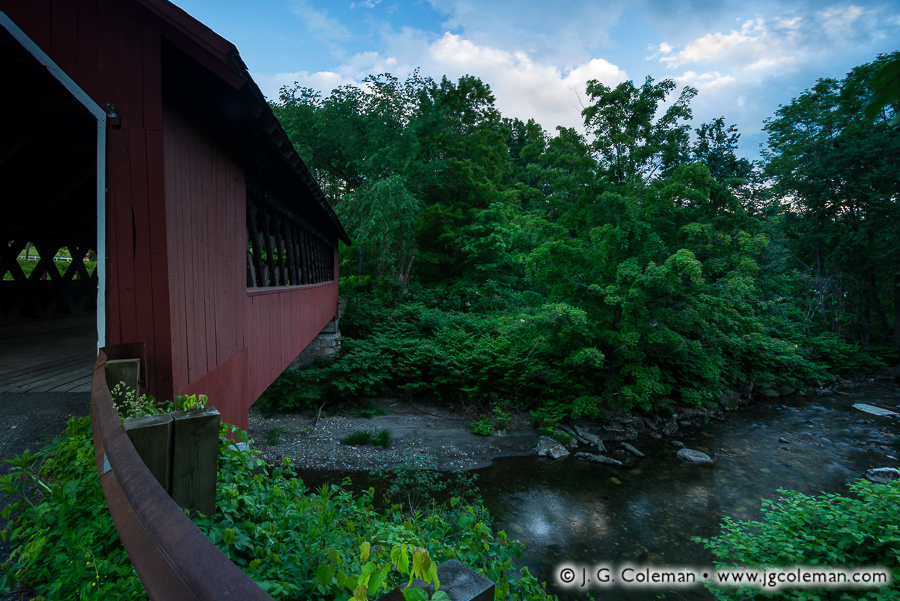
When I arrived at the 137-year-old Creamery Covered Bridge in Brattleboro, it was early June. The surrounding woods were alive with jostling leaves and bird songs and I was serenaded by the murmur of a lively creek as it meandered through the shallow gorge below.

Whetstone Dusk (Creamery Covered Bridge over Whetstone Brook, Brattleboro, Vermont)
“Whetstone Dusk”
Creamery Covered Bridge over Whetstone Brook, Brattleboro, Vermont
© 2016 J. G. Coleman

The view from the road didn’t strike me at first, so I made my way down beside the water. “This still won’t do,” I determined, unable to get a clear view of the bridge from the forest-crowded riverbank. Off came my shoes and socks and, with pant legs rolled up, I waded into the cool waters of Whetstone Brook where I found the vista I had envisioned!

Ahhh, those warm days will be back soon enough, folks! Until then, stay warm and avoid wading barefoot in any streams…

Purchase a Fine Art Print or Inquire About Licensing

Click here to visit my landing page for “Creamery Crossing at Brattleboro” to buy a beautiful fine art print or inquire about licensing this image.

Want to See More?

Be sure to check out all of my work from the Creamery Covered Bridge.

Categories
All Things Connecticut New Print Releases The American Northeast

Enders Frozen Cradle

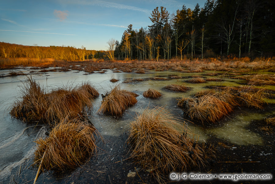
Enders Frozen Cradle (Hoyt Hayes Swamp, Enders State Forest, Barkhamsted, Connecticut)
“Enders Frozen Cradle”
Hoyt Hayes Swamp at Enders State Forest, Barkhamsted, Connecticut
© 2017 J. G. Coleman

Ice-bound amidst the shallows of Hoyt Hayes Swamp (above), frosted tufts of sedge flutter gently with a frigid breeze that sweeps across the open wetlands. As we peer out over the shadowy expanse of ice towards the nearby woodline, we find leaf-bare trees gratefully embracing the warmth and auburn glow of the rising sun.

Nestled in the wild northern hills of Connecticut, Enders State Forest hosts a striking series of waterfalls which are undoubtedly among the state’s most famous. As Enders Brook courses through the woodlands, it plunges and tumbles over five cliffs in less than a quarter-mile. In fact, the waterfalls are so popular that folks are apt to forget entirely about the other 2,000 acres of land encompassed within the state forest!

My latest piece represents an effort to tell a fresh, often-overlooked story of this landscape by bringing us a mile west of the waterfalls to the tract of wetlands where Enders Brook is born. There could hardly be a starker contrast than that of the icy stillness of Hoyt Hayes Swamp and the swift, raucous waterfalls it nourishes downstream.

Purchase a Fine Art Print or Inquire About Licensing

Click here to visit my landing page for “Enders Frozen Cradle” to buy a beautiful fine art print or inquire about licensing this image.

Want to See More?

Be sure to check out all of my work from Enders State Forest.

Categories
All Things Connecticut New Print Releases The American Northeast

Ceaseless Waterfalls

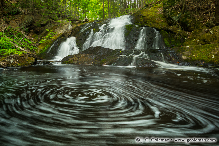
Graham's Secret (Carr Brook Falls, Portland, Connecticut)
“Graham’s Secret”
Carr Brook Falls, Portland, Connecticut
© 2016 J. G. Coleman

In “Graham’s Secret” (above), the latest installment in my Waterfalls of Connecticut project, the cool waters of Carr Brook slip over a forest-shaded cliff, descending into a ceaseless whirlpool at the bottom of a rugged ravine just a few miles east of the Connecticut River.

When I set about my “Connecticut Waterfalls” project back around 2010, eager to interpret the beauty of the Nutmeg State’s varied natural waterfalls, I’m not sure that I was thinking about how long it might take to see the endeavor through to its conclusion. And so here I am, after more than six years of work, and I’m still expanding the formal collection a couple times each year with imagery from new waterfalls.

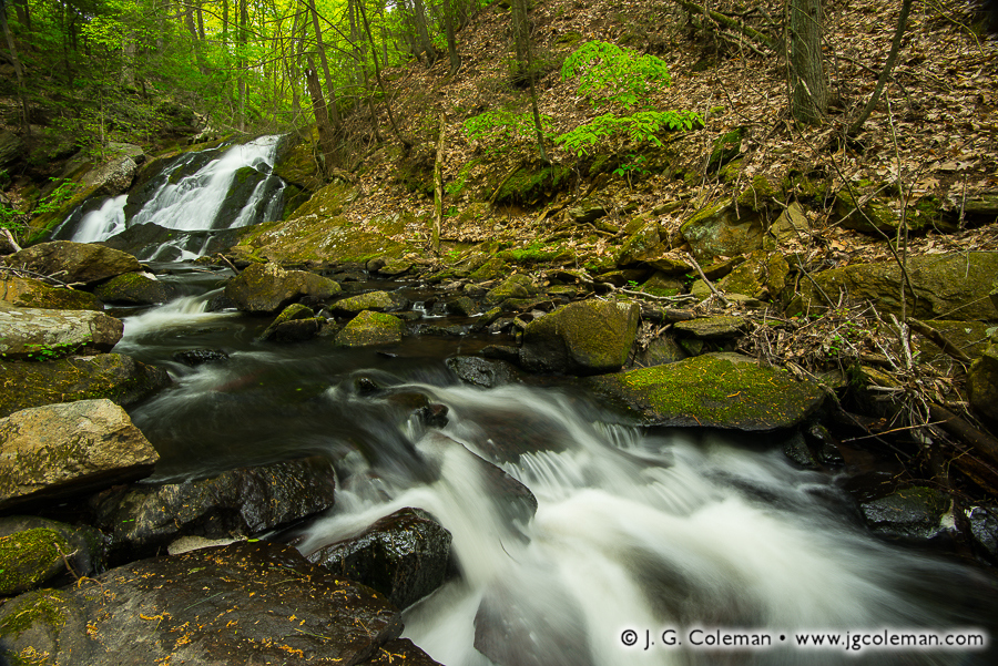
Flume at Collins Hill (Carr Brook Falls, Portland, Connecticut)
“Flume at Collins Hill”
Carr Brook Falls, Portland, Connecticut
© 2016 J. G. Coleman

Of course, the core of the project came together a couple years ago in the form a dedicated website, “Waterfalls of Connecticut”, which I invite you to visit. But even as I was busy pulling together the body of work that would premier in the collection, an effort which might customarily mark the end of a thematic project, I knew that waterfalls had earned an enduring place in my subject matter for years to come. I also knew that there was, and still remains, a great many stories of cascading water left to tell in the wilds of Connecticut.

Purchase a Fine Art Print or Inquire About Licensing

Click here to visit my landing page for “Graham’s Secret” to buy a beautiful fine art print or inquire about licensing this image.

Want to See More?

Be sure to check out all of my work from Carr Brook Falls.

Categories
All Things Connecticut New Print Releases The American Northeast

A Millstone and Main’s Saw

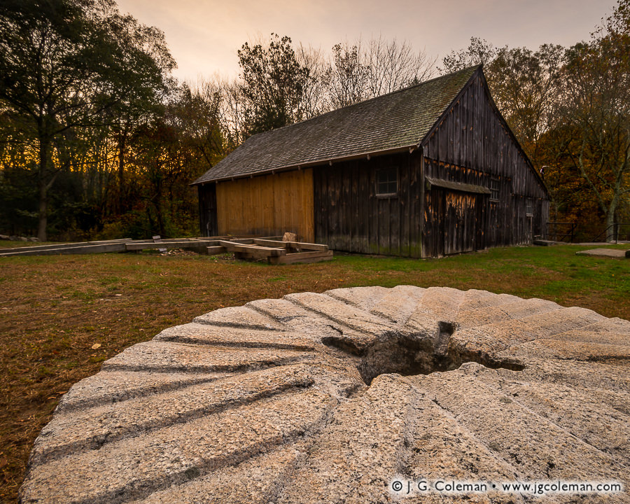
Millstone and Main's Saw (Ledyard Up-down Sawmill, Sawmill Park, Ledyard, Connecticut)
“Millstone and Main’s Saw”
Ledyard Up-down Sawmill at Sawmill Park, Ledyard, Connecticut
© 2016 J. G. Coleman

Dark woodlands, growing ever more leaf-bare as October wanes, rise up behind an old, weather-beaten sawmill in southeastern Connecticut. Nearby, the keyed eye and carefully chiseled grooves of an ancient millstone serve to further recall the days when small, industrious, stream-side mills churned away at the heart of New England’s villages.

Perched beside the sluiceway of a two-acre millpond in the heart of Ledyard, the old Main Sawmill remarkably changed hands only twice since it was constructed in the 19th century. Built by the Brown family in 1877, it proved to be something of a financial failure and was transferred by foreclosure to the Main family in 1902. The Mains operated the mill occasionally until it was damaged by the Great Hurricane of 1938. By the 1960s, in recognition of its historical value, the antique sawmill was purchased by the town of Ledyard to be restored and preserved.

The mill saws logs by lifting and dropping a long, toothed blade along the cut axis, a system known colloquially as an “up-down” saw. Interestingly, the “up-down” design was considered outdated even when the mill was originally built in the 1870s! Why the Brown family neglected to build their mill with a more modern circular saw is anybody’s guess. In retrospect, though, that questionable decision has paid dividends by offering today’s generation a glimpse into sawmill technology that dates back even further than the mill itself!

Purchase a Fine Art Print or Inquire About Licensing

Click here to visit my landing page for “Millstone and Main’s Saw” to buy a beautiful fine art print or inquire about licensing this image.

Want to See More?

Be sure to check out all of my work from the Ledyard Up-down Sawmill and Sawmill Park.

Categories
New Print Releases The American Northeast

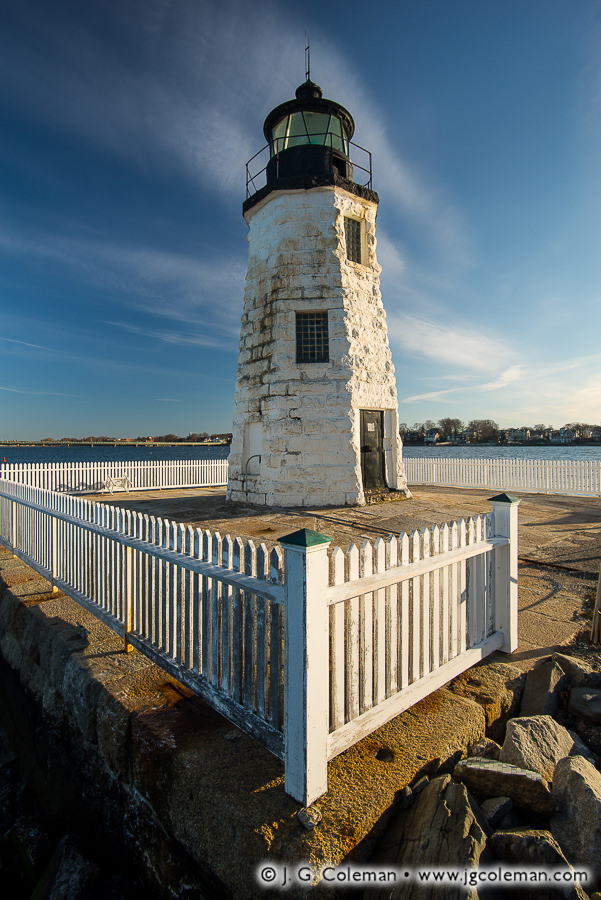
Abiding Guardian of Newport Harbor

Abiding Guardian of Newport Harbor (Newport Harbor Lighthouse, Newport, Rhode Island)
“Abiding Guardian of Newport Harbor”
Newport Harbor Lighthouse (aka Goat Island Light), On Goat Island in Newport Harbor, Newport, Rhode Island
© 2016 J. G. Coleman

The rough-cut granite trunk of the Newport Harbor Light, its white paint besieged by the elements, climbs steeply above the waters of Rhode Island’s Narragansett Bay. Dawn casts warm, revealing light upon the weathered slab foundation and worn, white-picket fence: it seems that every facet of this old beacon carries the scars of a long, hard-earned life on the New England coast.

Of the exquisite array of lighthouses along Rhode Island’s shores, the relatively plain and diminutive Newport Harbor Light is often overlooked. But this humble beacon, now over 170 years old, has faithfully kept watch over seven generations of mariners and Rhode Islanders alike. If these enduring walls of granite could talk, they would surely tell boundless tales of places long-changed and people long-forgotten.

One of the most unusual stories surrounding the Newport Harbor Lighthouse –perhaps any lighthouse, for that matter– came about in 1921. On November 9 of that year, in an incident that sounds almost unbelievable, a 150-foot-long submarine accidentally rammed into the breakwater upon which the lighthouse and keeper’s cabin stood. The keeper’s cabin was a loss, being demolished shortly afterwards, but the lighthouse thankfully survived and continues guiding vessels to this very day.

Purchase a Fine Art Print or Inquire About Licensing

Click here to visit my landing page for “Abiding Guardian of Newport Harbor” to buy a beautiful fine art print or inquire about licensing this image.

Want to See More?

Be sure to check out all of my work from Rhode Island.

Categories
All Things Connecticut New Print Releases The American Northeast

Waterville Echoes

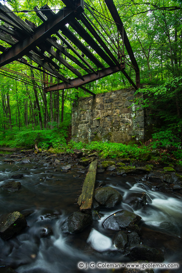
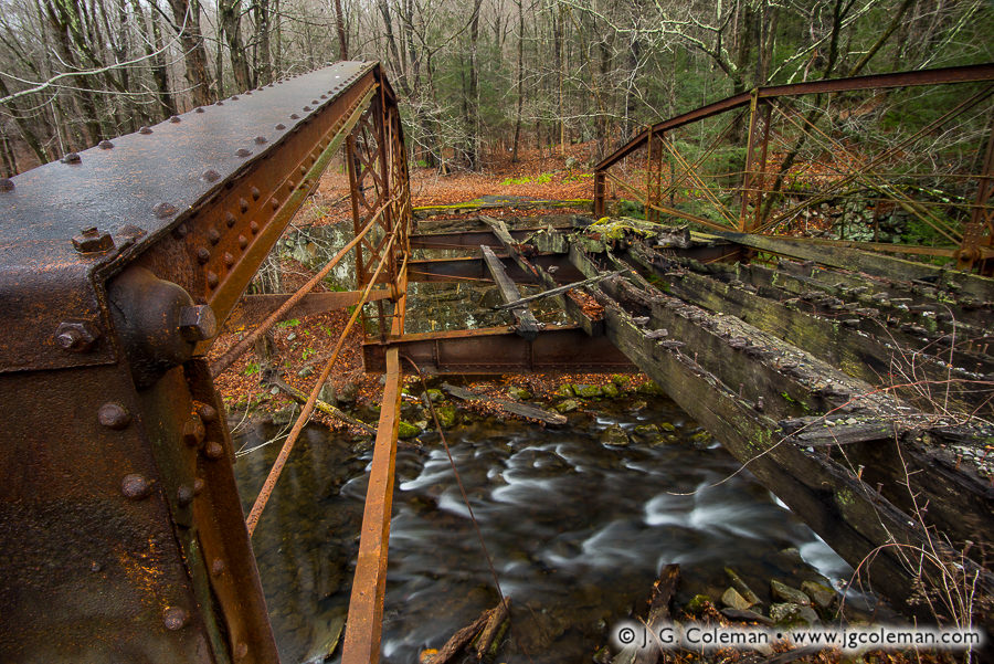
Sheffield Revenant (Old Sheffield Street Iron Bridge, Mattatuck State Forest, Waterbury, Connecticut, USA)
“Sheffield Revenant”
Old Sheffield Street Iron Bridge,
Mattatuck State Forest, Waterbury, Connecticut
© 2016 J. G. Coleman

The year was 1884. The Waterville manufacturing district in the north of Waterbury had grown to be quite the industrial powerhouse, churning out a seemingly endless supply of brass and cutlery. But Hancock Brook, a tributary of the Naugatuck River which coursed through a steep ravine along Sheffield Street, was a routine impediment to the transport of goods eastward.

Iron Relic of Waterville (Old Sheffield Street Iron Bridge, Mattatuck State Forest, Waterbury, Connecticut)
“Iron Relic of Waterville”
Old Sheffield Street Iron Bridge,
Mattatuck State Forest, Waterbury, Connecticut
© 2016 J. G. Coleman

In an era when wooden covered bridges were still being phased out of mainstream construction in New England, the famous Berlin Iron Bridge Company was contracted to build a hefty iron bridge over Hancock Brook that would accommodate two lanes and exceptionally heavy loads. For years afterward, as countless tons of product fresh from the Waterville factories began their journey to distant destinations, they first cleared Hancock Brook over the Sheffield Street Bridge.

But that was then; this is now. As Waterbury’s golden age of manufacturing declined, the industrial landscape it occupied atrophied and eventually grew wilder than it had been in over a century. Today, the forgotten bridge off Sheffield rusts away in the forest near an isolated quarry. Much of the old wooden decking has long-since decayed, though stray planks sometimes still break free and plunge into the waters below. All that remains of the Sheffield Street Bridge is a haunting, iron skeleton hung high above Hancock Brook… an eerie, lonesome witness of bygone times marooned in a vastly different world from the one in which it was born.

Purchase a Fine Art Print or Inquire About Licensing

Click here to visit my landing page for “Sheffield Revenant” to buy a beautiful fine art print or inquire about licensing this image.

Want to See More?

Be sure to check out all of my work from Mattatuck State Forest.

Categories
All Things Connecticut New Print Releases The American Northeast

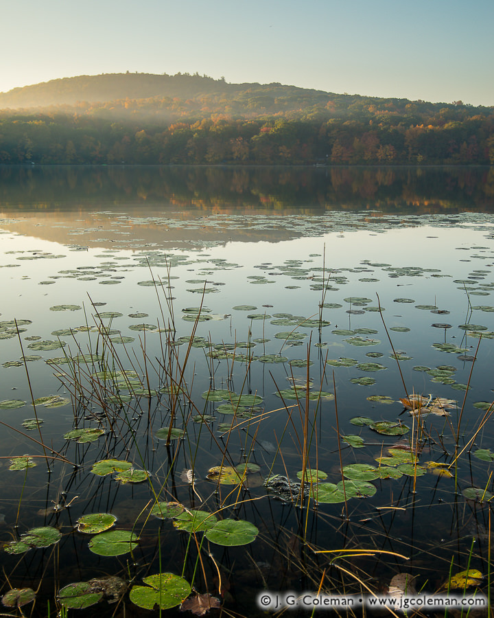
Waking the Shadows of Mount Tom

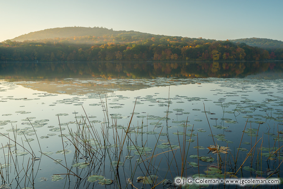
Waking the Shadows of Mount Tom (Mount Tom State Park, Litchfield, Connecticut)
“Waking the Shadows of Mount Tom”
Mount Tom & Mount Tom Pond,
Mount Tom State Park, Litchfield, Connecticut
© 2016 J. G. Coleman

A flurry of shoots all over Connecticut and Massachusetts during this past autumn has left me with a backlog of some 2,000 photographs which I’ve been meticulously processing since mid-December. There’s so much new imagery that I’m eager to share over the coming year!

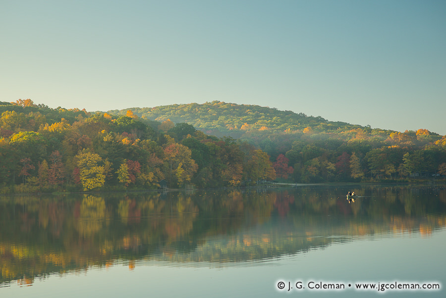
For now, I’d like to offer a couple pieces that I finished developing last night. In “Waking the Shadows of Mount Tom” (at top), we find ourselves amidst lily pads and grasses on the shores of Mount Tom Pond during mid-October. Sunlight breaks over mist-laden hills in the distance as dawn lends comforting warmth to the landscape. The same luminous morning offered a dreamy backdrop for “They Who Dwell in Reflections” (below), in which we find a solitary boat of fishermen amidst the the majesty of autumn forests, morning haze and the mirror-like waters of the pond.

They Who Dwell in Reflections (Mount Tom Pond, Mount Tom State Park, Litchfield, Connecticut)
“They Who Dwell in Reflections”
Fishermen on Mount Tom Pond,
Mount Tom State Park, Litchfield, Connecticut
© 2016 J. G. Coleman

Despite being a fairly small lake, at only about 55 acres, Mount Tom Pond actually straddles a “tri-point” of town boundaries. So while the bulk of open water is in Litchfield, the southern end of the pond reaches into Washington and the eastern shore of the pond falls within in Morris.

Purchase a Fine Art Print or Inquire About Licensing

Visit my landing page for “Waking the Shadows of Mount Tom” or “They Who Dwell in Reflections” to buy a beautiful fine art print or inquire about licensing these images.

Want to See More?

Be sure to check out all of my work from Mount Tom State Park.

Categories
New Print Releases The American Northeast

Taft’s Crossing on the Ottauquechee

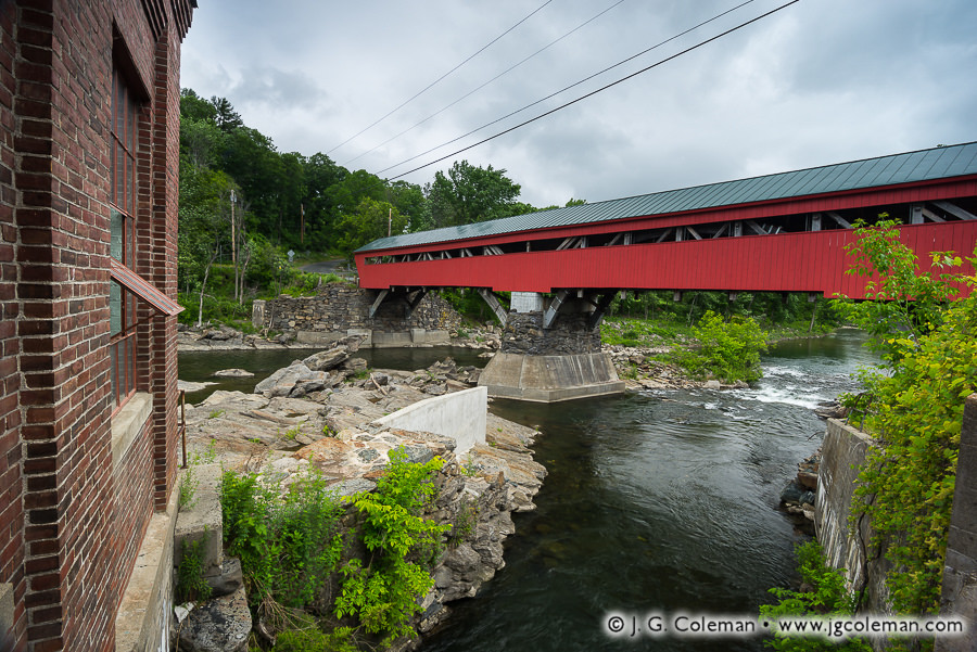
Taft's Crossing on the Ottauquechee (Taftsville Covered Bridge, Woodstock, Vermont)
“Taft’s Crossing on the Ottauquechee”
Taftsville Covered Bridge, Woodstock, Vermont
© 2016 J. G. Coleman

In my latest release, “Taft’s Crossing on the Ottauquechee” (above), the iconic, 180-year-old Taftsville Covered Bridge reaches nearly 200 feet across the Ottauquechee River in Central Vermont, its robust timber frame perched on massive abutments high above the rugged, rock-strewn gorge below.

Since 1807, the townspeople of Taftsville had been building bridges over the Ottaquechee River in this very spot, only to watch them get washed away by floodwaters again and again over the course of just a couple decades. The impressive Taftsville Bridge, completed in 1836, was intended to buck that exasperating trend once and for all. Today, it stands as one of the oldest covered bridges left in the United States. However, that reputation for endurance nearly came to an abrupt end in 2011 when Hurricane Irene charged through Vermont, bringing record rainfall on the heels of an already wet season.

Rivers all over the state brimmed and erupted from their banks. You’ll notice that the Taftsville Bridge is quite high above the river gorge, perhaps 30 feet or thereabouts. As the hurricane raged, though, the Ottaquechee rose so high that whitewater was crashing furiously against its siding! Remarkably, the bridge was spared and, after a few years of careful rehabilitation, reopened to traffic for its next 180 years of service.

Purchase a Fine Art Print or Inquire About Licensing

Click here to visit my landing page for “Taft’s Crossing on the Ottauquechee” to buy a beautiful fine art print or inquire about licensing this image.

Want to See More?

Be sure to check out all of my work from the Taftsville Covered Bridge.

Categories
All Things Connecticut New Print Releases The American Northeast

Veiled Realm of Black Rock

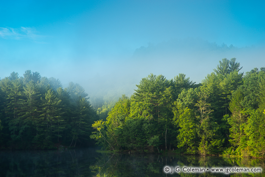
Veiled Realm of Black Rock (Black Rock Pond at Black Rock State Park, Watertown, Connecticut)
“Veiled Realm of Black Rock”
Black Rock Pond at Black Rock State Park, Watertown, Connecticut
© 2016 J. G. Coleman

Sublime mist drifts through the woodlands of Western Connecticut, rendering distant hills in hazy silhouette against an airy, cerulean sky. Deep in the basin below, still waters of Black Rock Pond yield unblemished reflections of a lakeside forest daubed with the lustrous light of dawn.

Connecticut’s Black Rock State Park encompasses over 400 acres of wildlands in the lower Litchfield Hills, its name hearkening back to an ancient history of graphite mining which is still largely shrouded in mystery. Legend holds that, long before European settlers arrived in the region, Native Americans living in these hills would collect graphite to make body paint for ceremonies and warfare.

Traditional stories go on, relating that the prospect of a large-scale graphite mine was among the earliest draws to these rugged forests for Connecticut Colony settlers in the 1600s. When historian Sarah Pritchard published an extensive history of the territory in 1896, she concluded that pioneering “explorers of the region reported the discovery of graphite, and samples of the mineral seem to have been carried away, but the location of the mine, if there was one, has been lost and never re-discovered.”

Purchase a Fine Art Print or Inquire About Licensing

Click here to visit my landing page for “Veiled Realm of Black Rock” to buy a beautiful fine art print or inquire about licensing this image.

Want to See More?

Be sure to check out all of my work from Black Rock State Park.